|
|
| |
| |||
|
|
My Big Introduction to Small Airstrips
2007 November 15
|
|
|
| |
|
| |||
|
|
|
 I love the American southwest.
I went to Moab for a long-weekend vacation.
When I got back, the folks at work asked how my trip was.
I said,
"I spent Thursday morning scared out of my wits
and Friday afternoon in hiking
exhaustion.
It was great!"
I love the American southwest.
I went to Moab for a long-weekend vacation.
When I got back, the folks at work asked how my trip was.
I said,
"I spent Thursday morning scared out of my wits
and Friday afternoon in hiking
exhaustion.
It was great!"
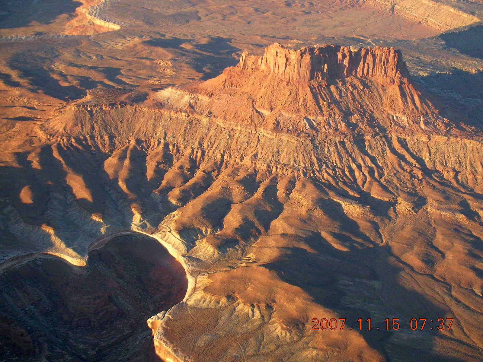
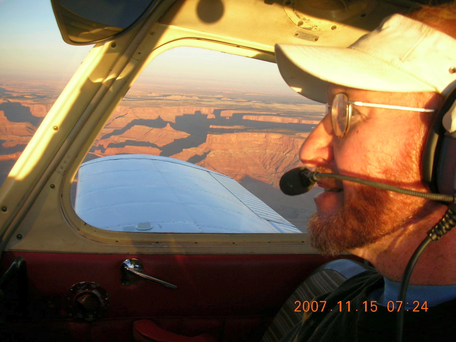
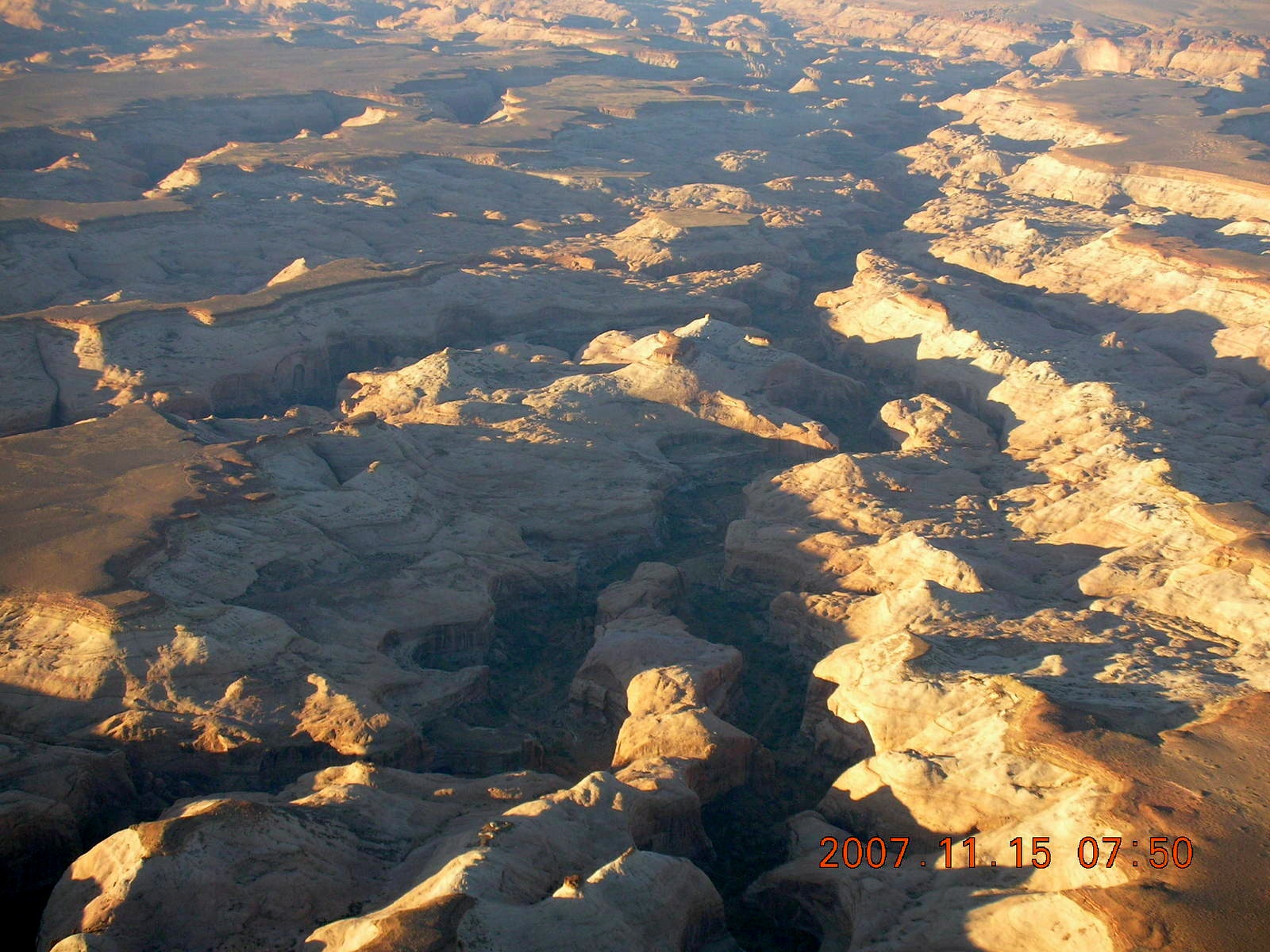
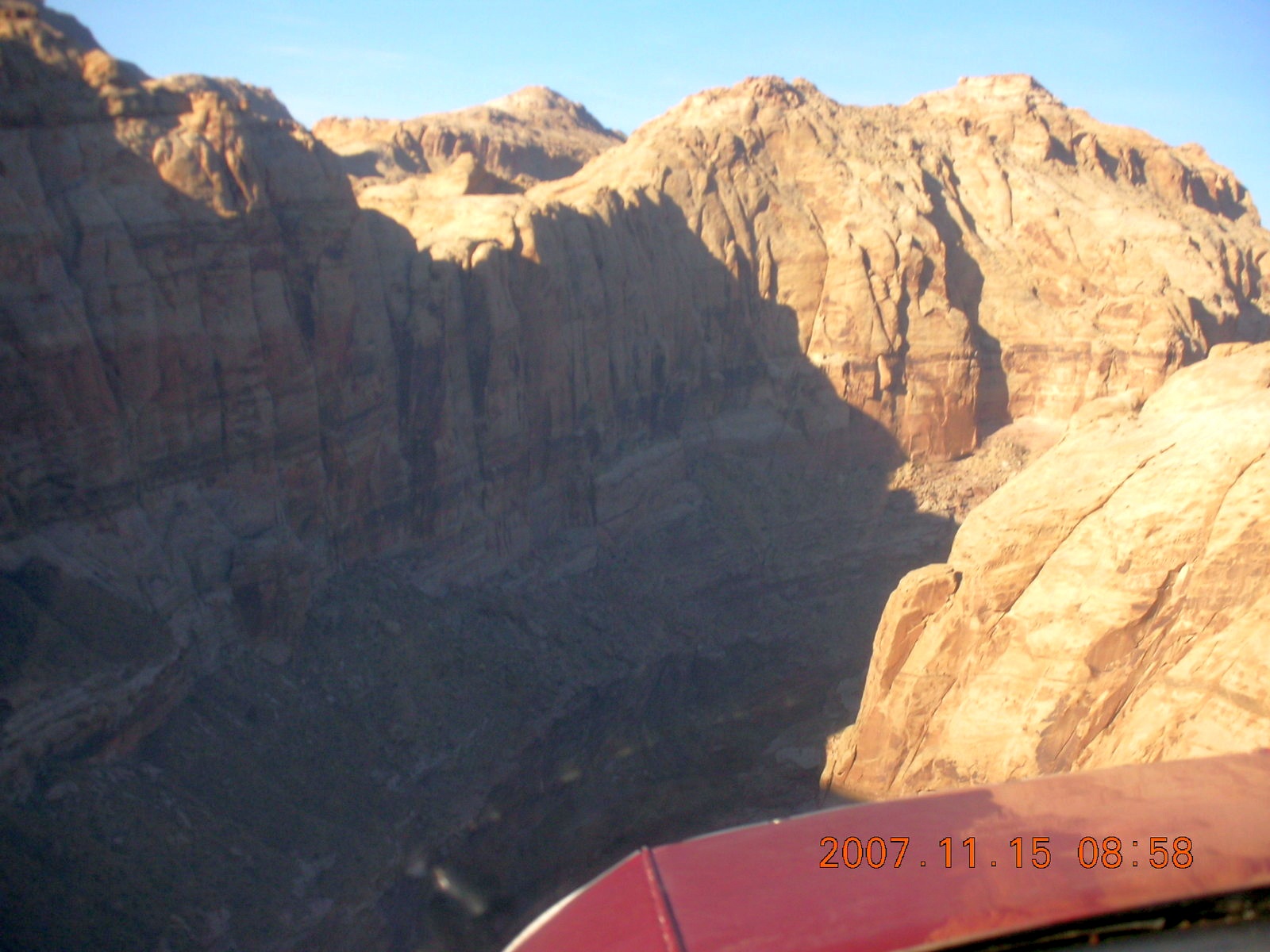
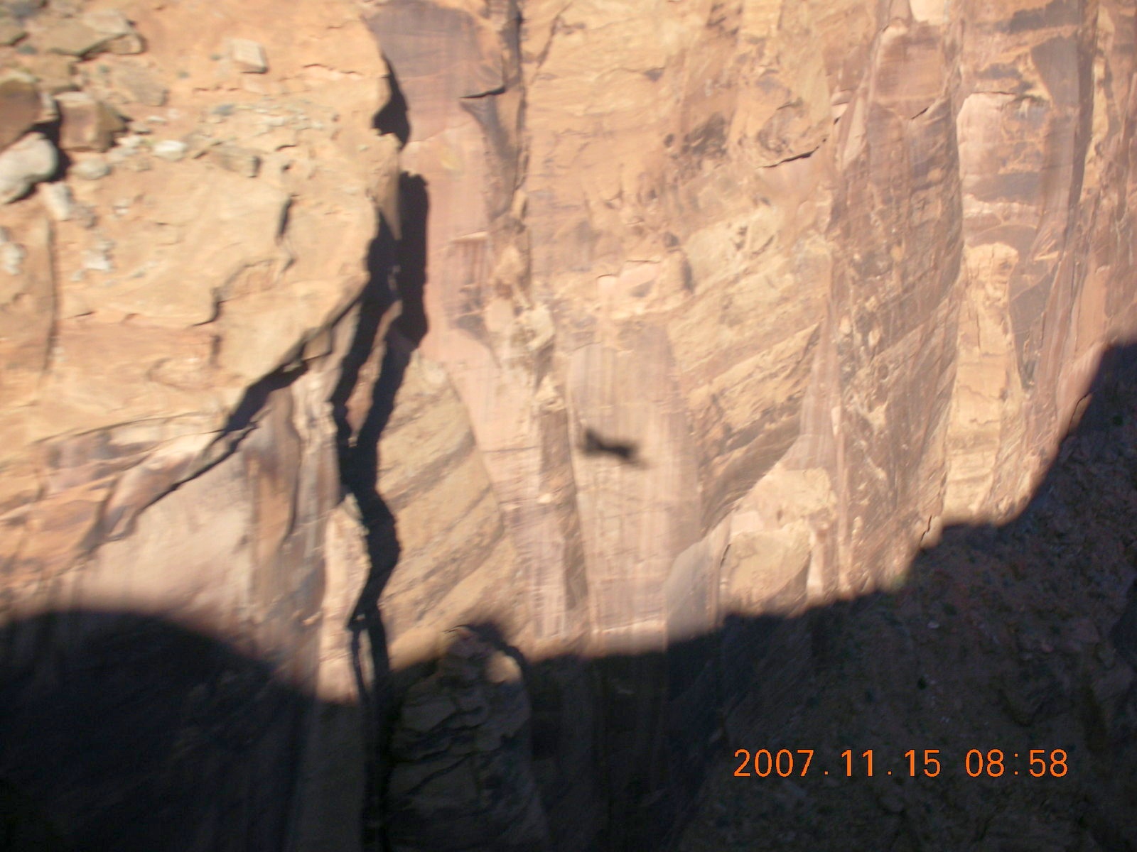
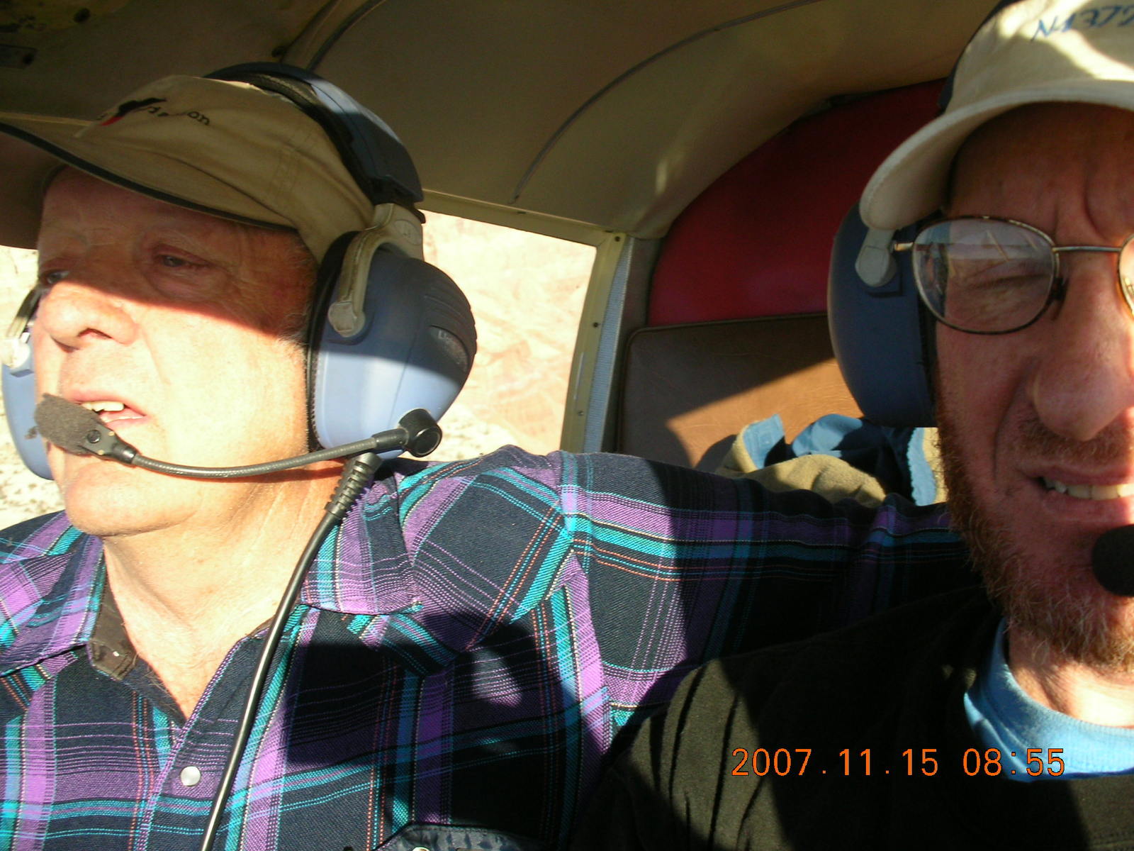
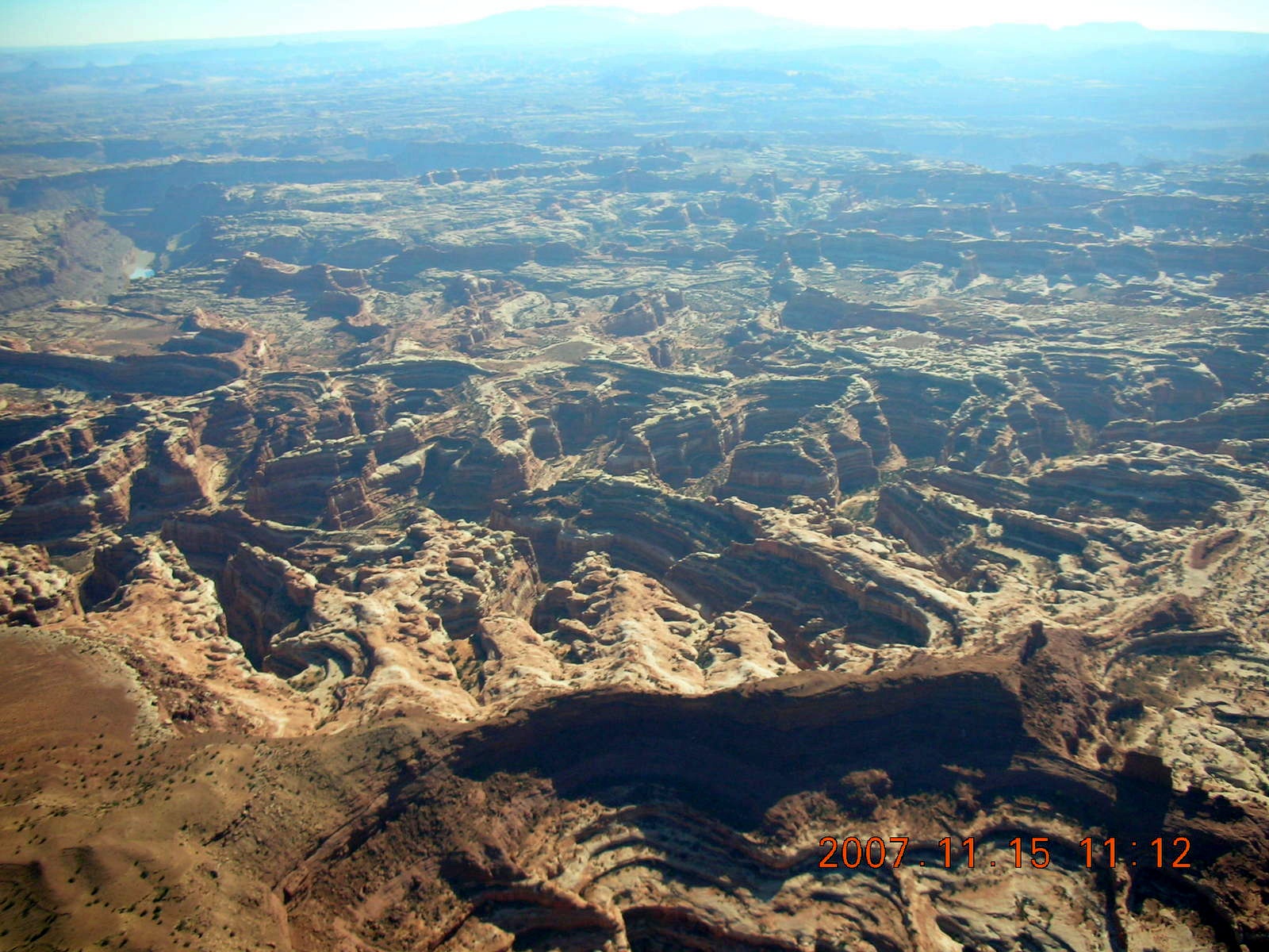
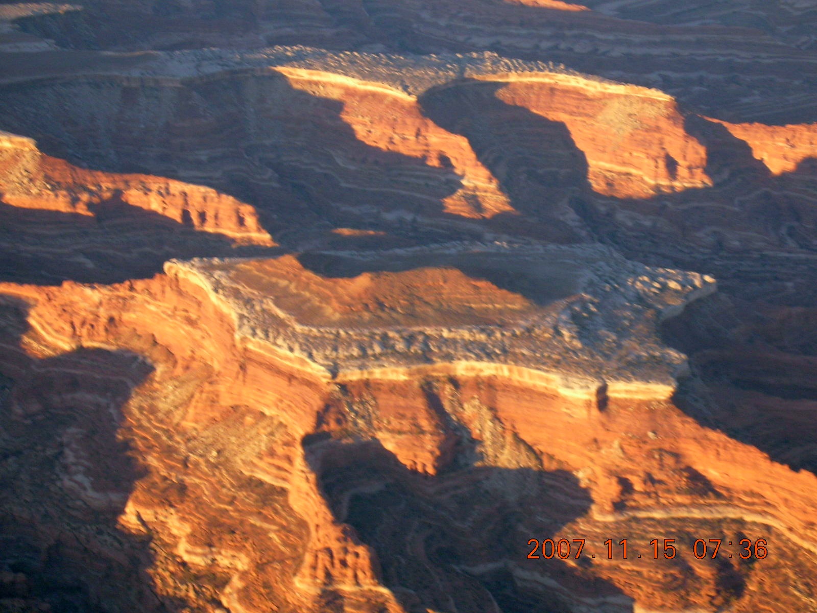
Thursday morning I took some flight instruction in the remote Utah desert, what they call "back-country" flying, learning to land in airstrips, narrow canyon approaches to short, thin strips of dirt. My instructor was LaVar Wells, a local legend in back-country flying and a true gentleman in his willingness to share this knowledge with those of us who aren't used to this side of aviation. I learned a lot about how beautiful this countryside is and how wonderful Utah's desert geology can be.
I also learned something about pilot skill. I learned there are dimensions to controlling an airplane other than being able to land on the near end of a runway. I consider myself an above-average 1500-hour pilot when it comes to landing on short runways, but LaVar introduced me to circumstances where the same precision is required in the approach phase and is enforced by canyon walls.
|
| |

|

|

|
 It started off as a fantasy,
one of those things you're going to do
someday
like rock climbing or running the marathon.
I got the DVD
Out There Flying
and it was fun to watch.
As I was planning my fourth trip to
Moab, Utah,
I figured I would call around
and see if I could get some real, back-country flight instruction.
It started off as a fantasy,
one of those things you're going to do
someday
like rock climbing or running the marathon.
I got the DVD
Out There Flying
and it was fun to watch.
As I was planning my fourth trip to
Moab, Utah,
I figured I would call around
and see if I could get some real, back-country flight instruction.
 I was referred to LaVar Wells,
a local legend in flying the Utah wilderness.
He was raised there and has been flying there for a long time.
He came with a reputation
not only as one who knows back-country flying in Utah
but as one who can teach back-country flying in Utah.
(The two are not the same thing,
lots of people know stuff
but aren't gifted at sharing that knowledge.)
I called and we arranged to fly
from Hanksville
(HVE),
about 50 nautical miles (90 Km)
from Canyonlands
(CNY).
It took me an hour to get there because I took the scenic route
and watched dawn over Canyonlands National Park.
I was referred to LaVar Wells,
a local legend in flying the Utah wilderness.
He was raised there and has been flying there for a long time.
He came with a reputation
not only as one who knows back-country flying in Utah
but as one who can teach back-country flying in Utah.
(The two are not the same thing,
lots of people know stuff
but aren't gifted at sharing that knowledge.)
I called and we arranged to fly
from Hanksville
(HVE),
about 50 nautical miles (90 Km)
from Canyonlands
(CNY).
It took me an hour to get there because I took the scenic route
and watched dawn over Canyonlands National Park.
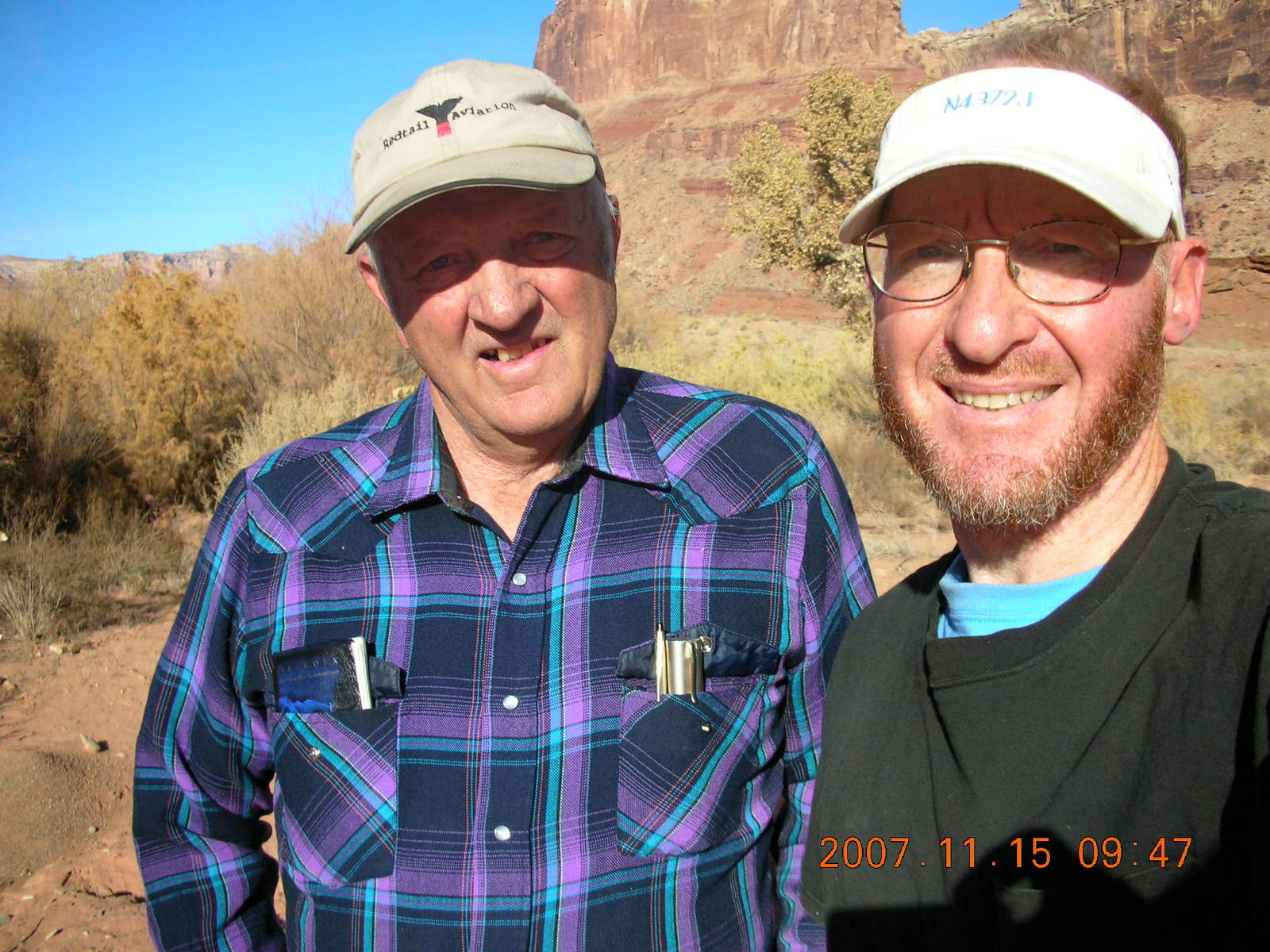
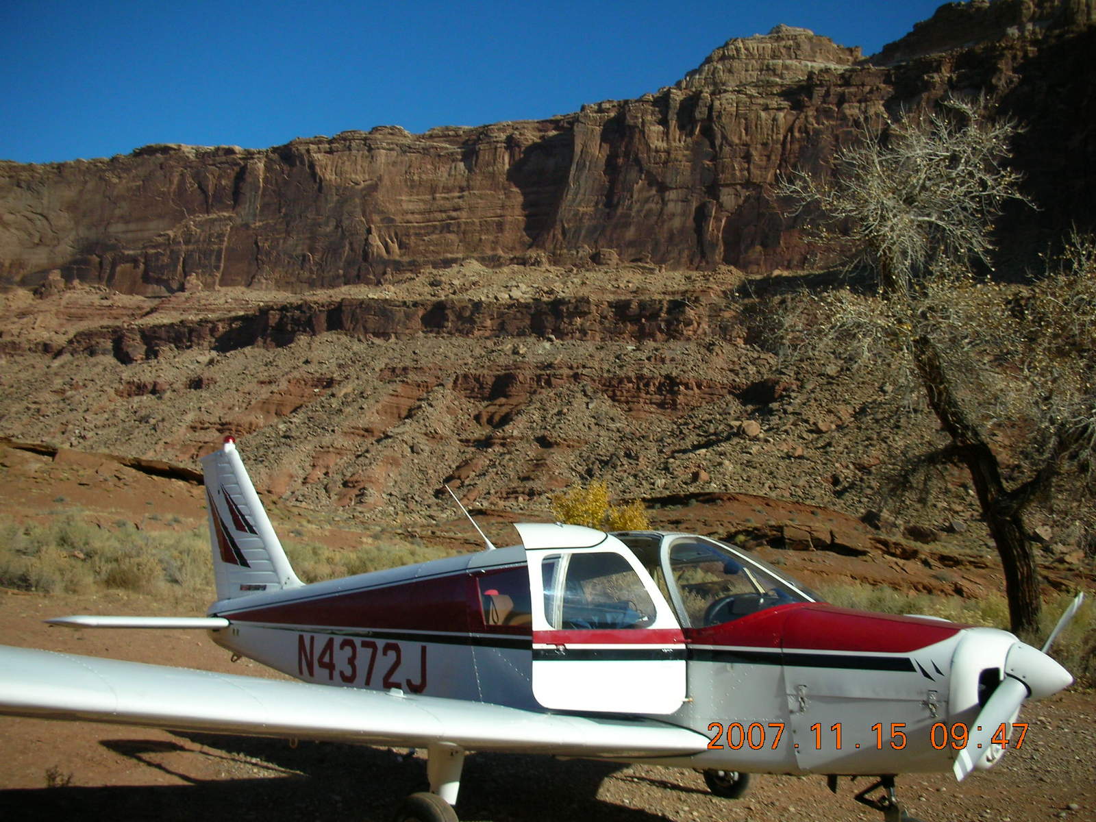
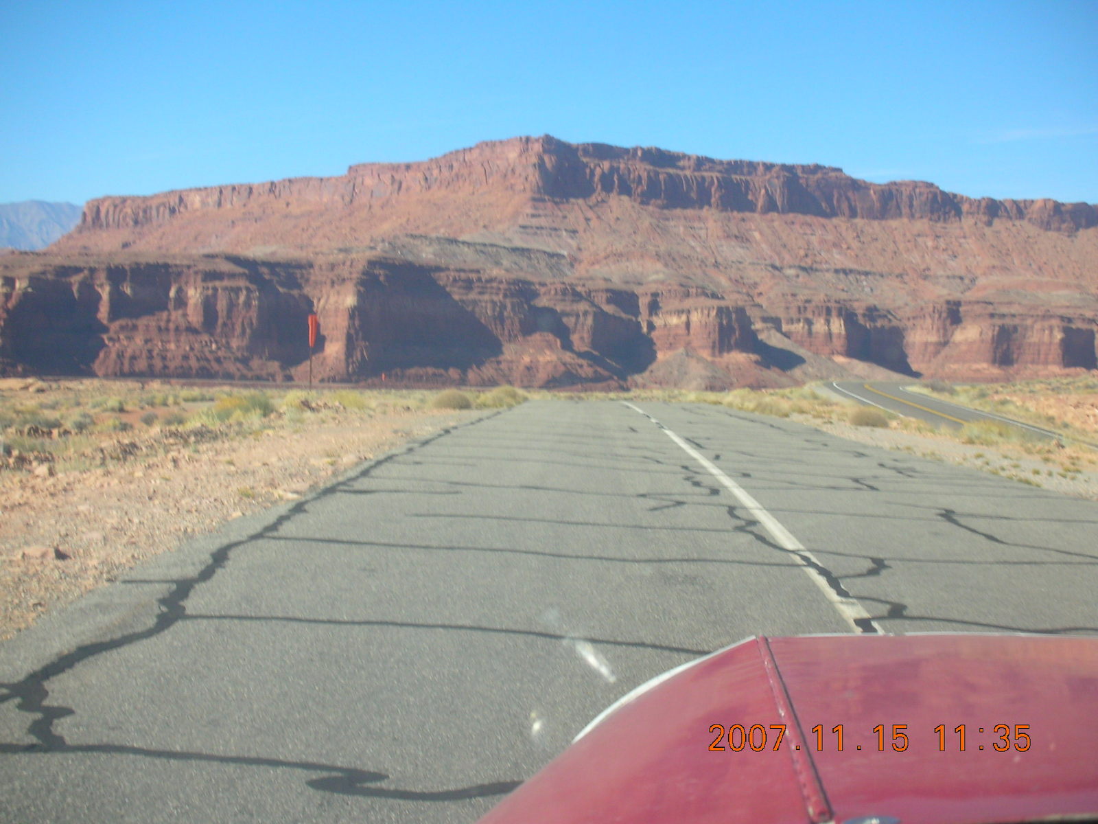
After we introduced ourselves, LaVar asked me to do a short field landing on the dirt runway at HVE. He wanted to know what my airplane could do with me at the controls. My first landing was perfect, we touched down right at the flare with no float at all and rolled to an easy stop in 500 feet (150 meters). My second attempt wasn't quite as perfect, but apparently he was impressed enough with my airmanship to take me into some of the more-challenging airstrips, beautiful ones as well.
I noticed that LaVar not only had the same headset as mine, he also had the same reference book, Fly Utah! You can buy a copy and follow along, it is delightful reading and has great pictures, too.
|
|
| |
|
|
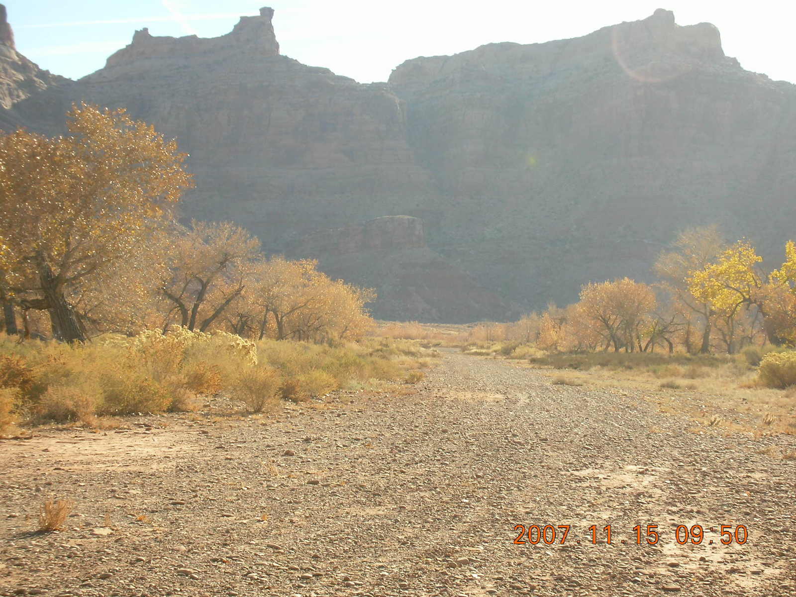
 "How about Hidden Splendor?"
I heard about Hidden Splendor
in various ways from
a fellow at Red Tail Aviation at
CNY,
the
Utah Back-Country Pilots Association (UBCP),
on a DVD video called
Out There Flying,
and even in
Pilot Getaways Magazine.
It's not on the regular charts from the Federal government,
but it's a purple circle (soft field) denoted
WPT660
on the
GH-UT Utah WAC Supplement Chart
that is available with
Fly Utah!
"How about Hidden Splendor?"
I heard about Hidden Splendor
in various ways from
a fellow at Red Tail Aviation at
CNY,
the
Utah Back-Country Pilots Association (UBCP),
on a DVD video called
Out There Flying,
and even in
Pilot Getaways Magazine.
It's not on the regular charts from the Federal government,
but it's a purple circle (soft field) denoted
WPT660
on the
GH-UT Utah WAC Supplement Chart
that is available with
Fly Utah!
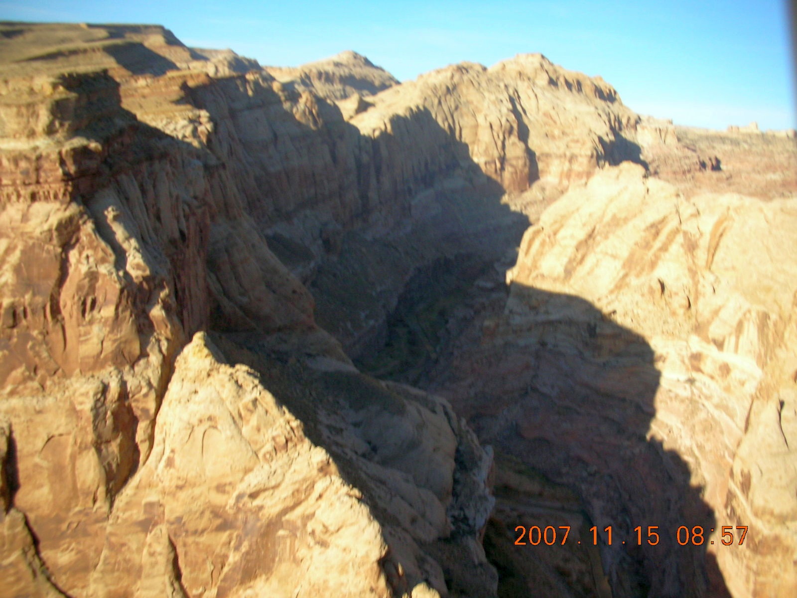
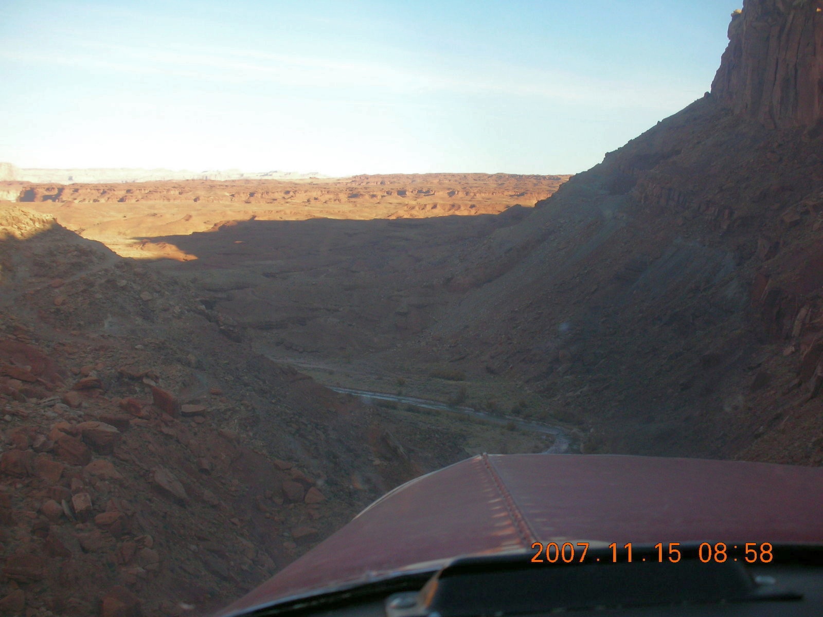
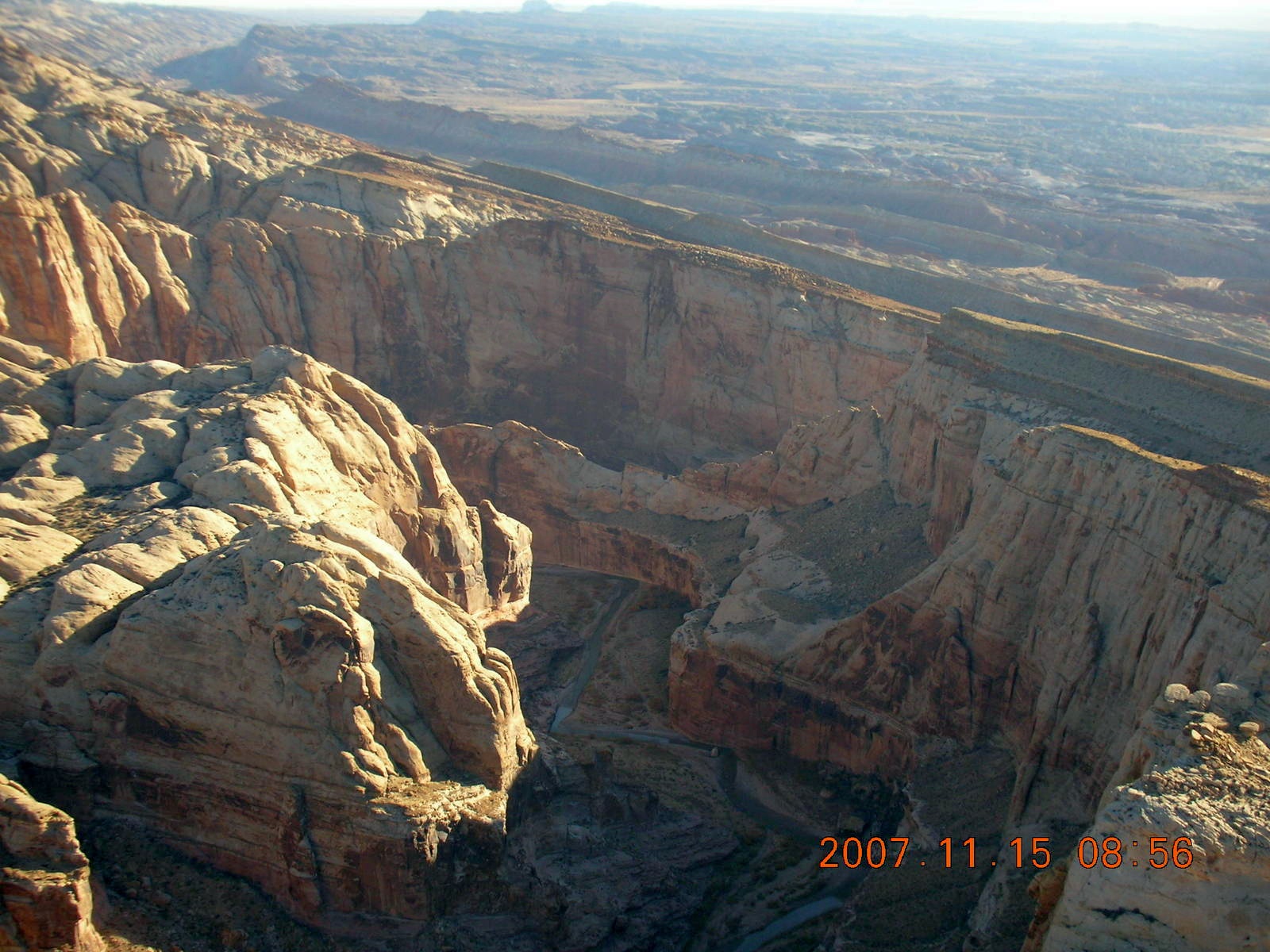
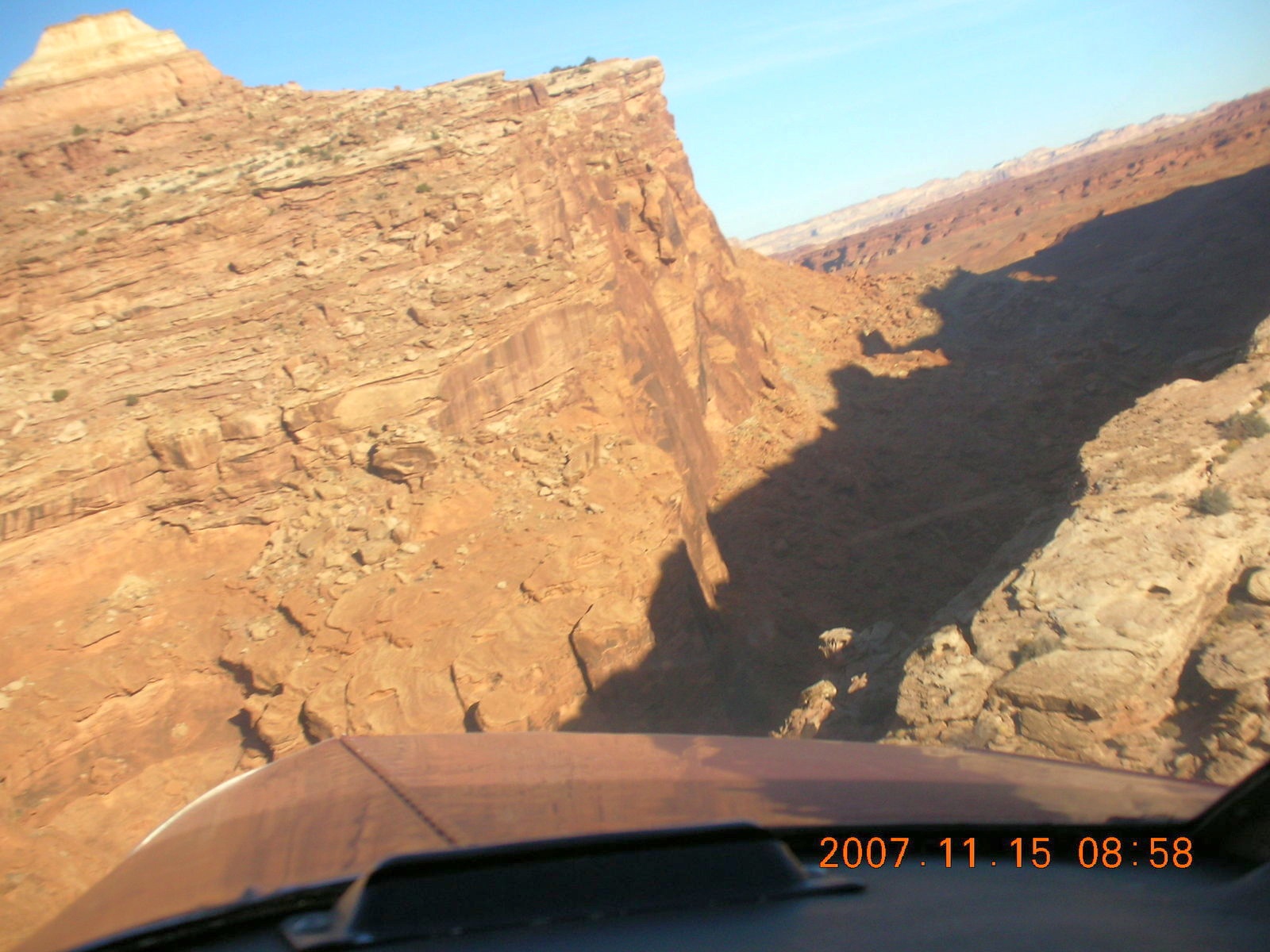
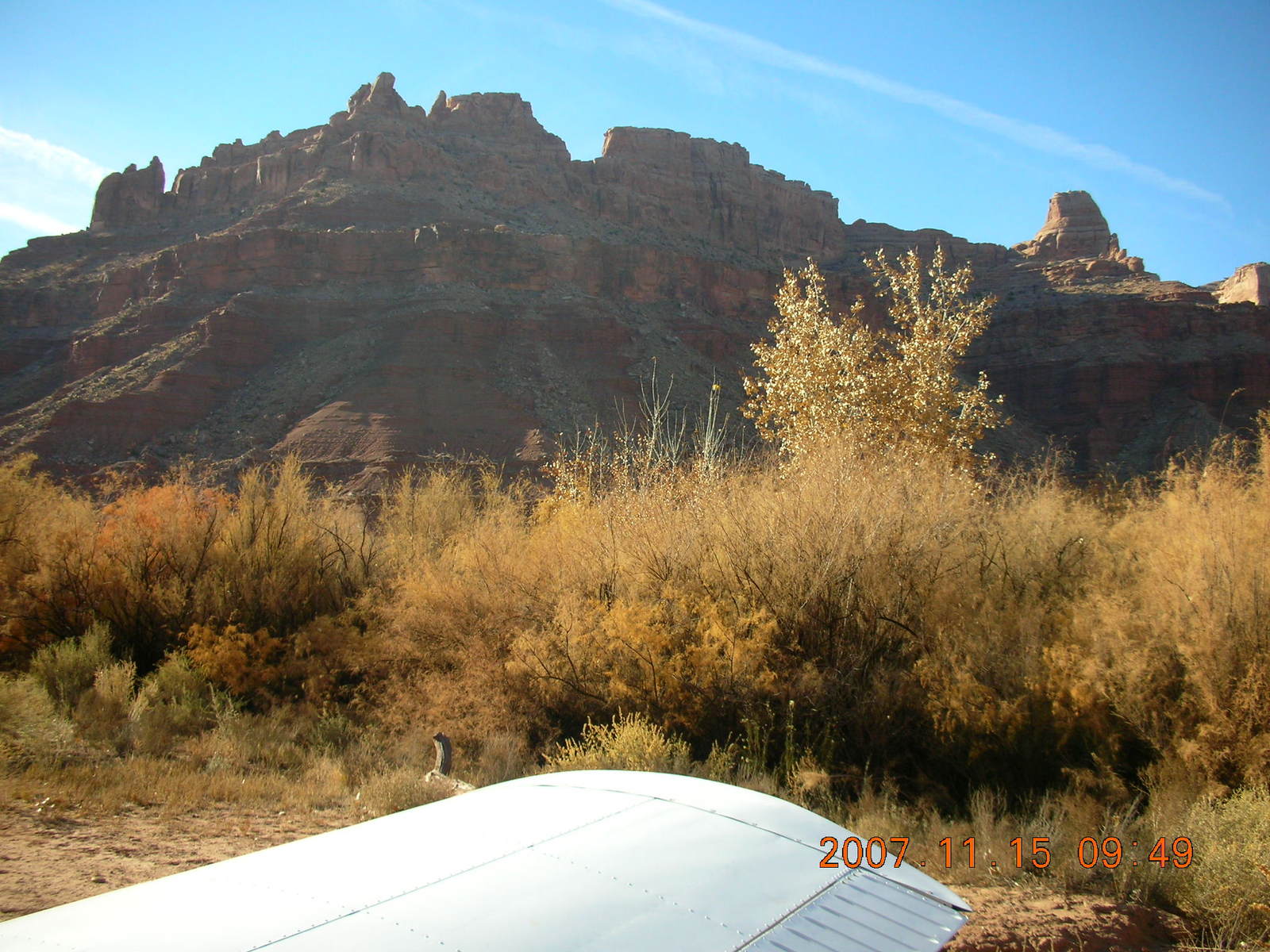
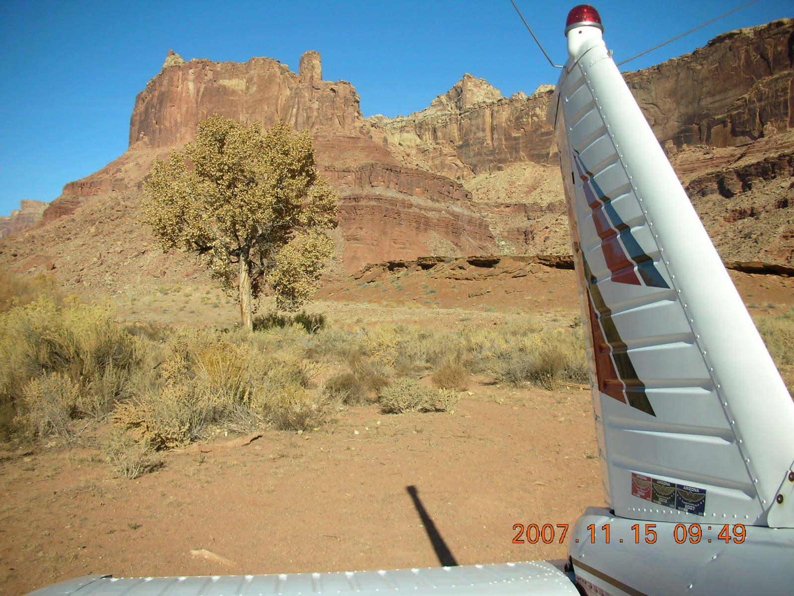
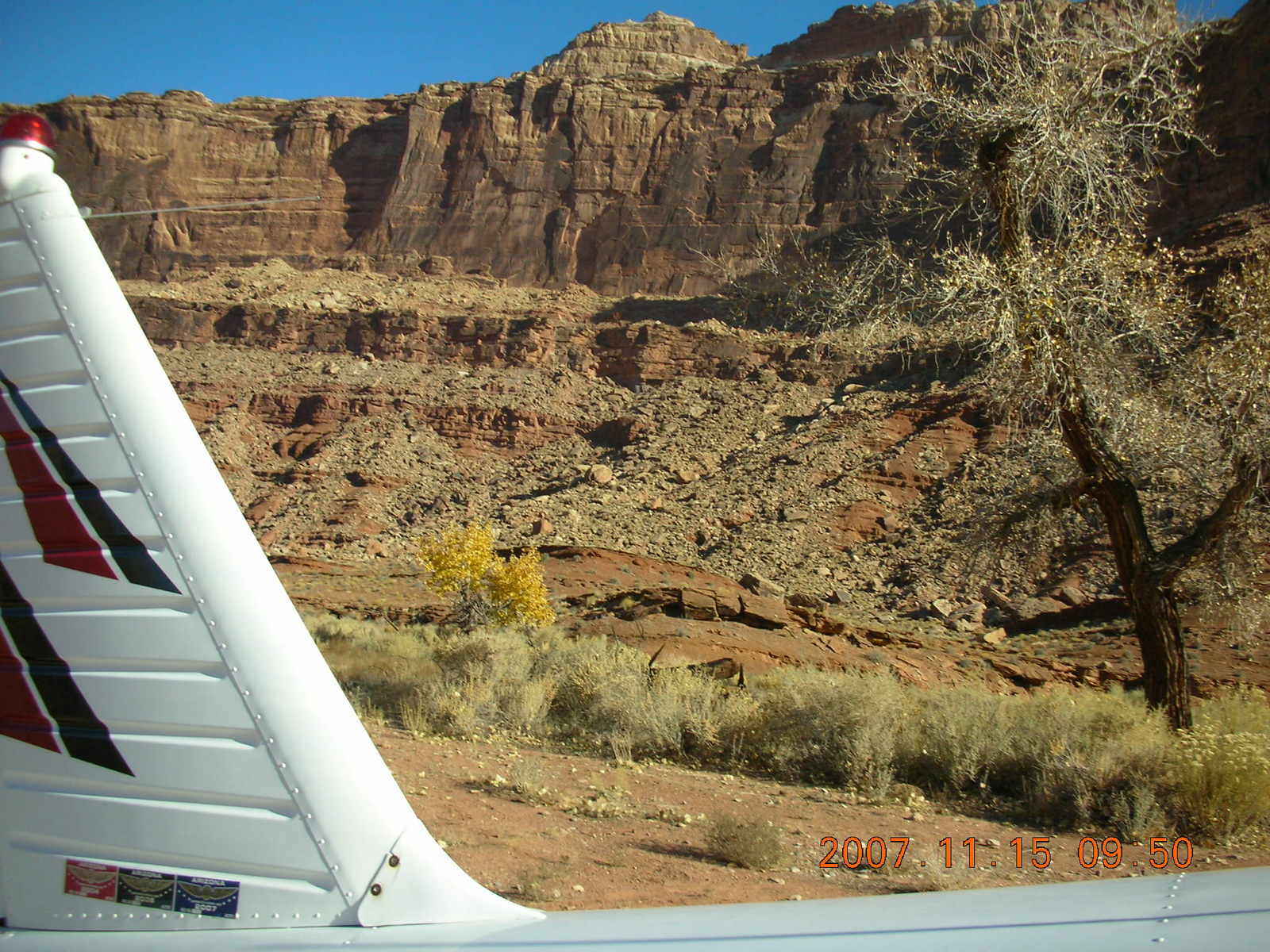
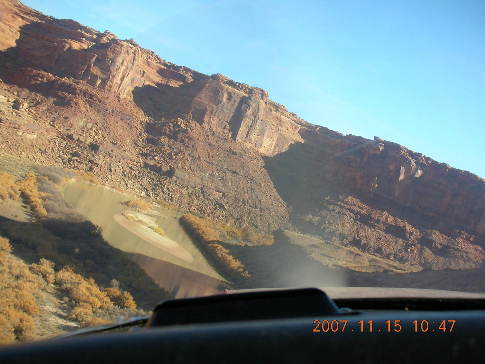
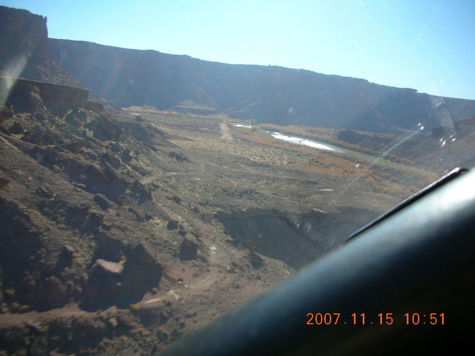
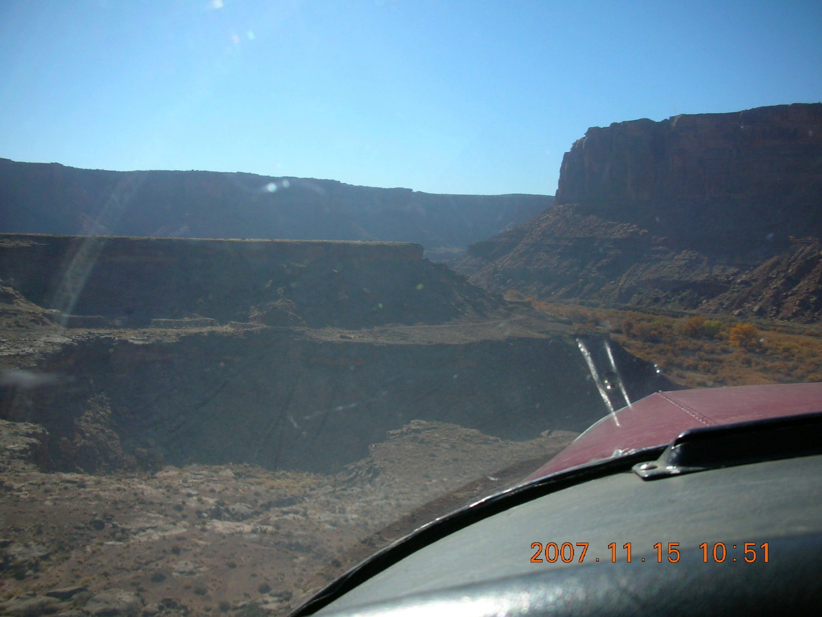
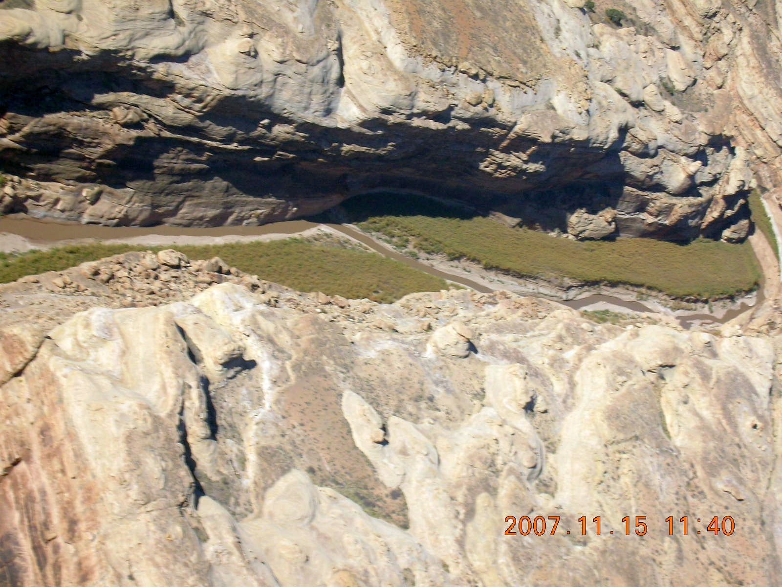
The description of Hidden Splendor is always focused on the narrow-canyon approach. So I could have some pictures of the inbound trajectory, I asked LaVar to fly the approach the first time and he said he would give me the controls just before touchdown. We flew over the airstrip first so I could see it and then we flew back around so he could follow the canyon to a nice landing.
 We took off the way we came,
downhill takeoff in light winds,
and I climbed out through the same canyon
with some sun in my eyes.
We took off the way we came,
downhill takeoff in light winds,
and I climbed out through the same canyon
with some sun in my eyes.
LaVar had me fly the next approach with some verbal coaching and that runway appears very suddenly on the right around the canyon wall. I had to scoot sideways a bit, as I would correct for a crosswind, and made a nice landing the second time.
 This time I suggested taking off away from the sun
and LaVar said we could just follow the river bed.
It's true, but the advantage of taking off downhill was lost
and we did not climb as quickly off the runway this time.
This time I suggested taking off away from the sun
and LaVar said we could just follow the river bed.
It's true, but the advantage of taking off downhill was lost
and we did not climb as quickly off the runway this time.
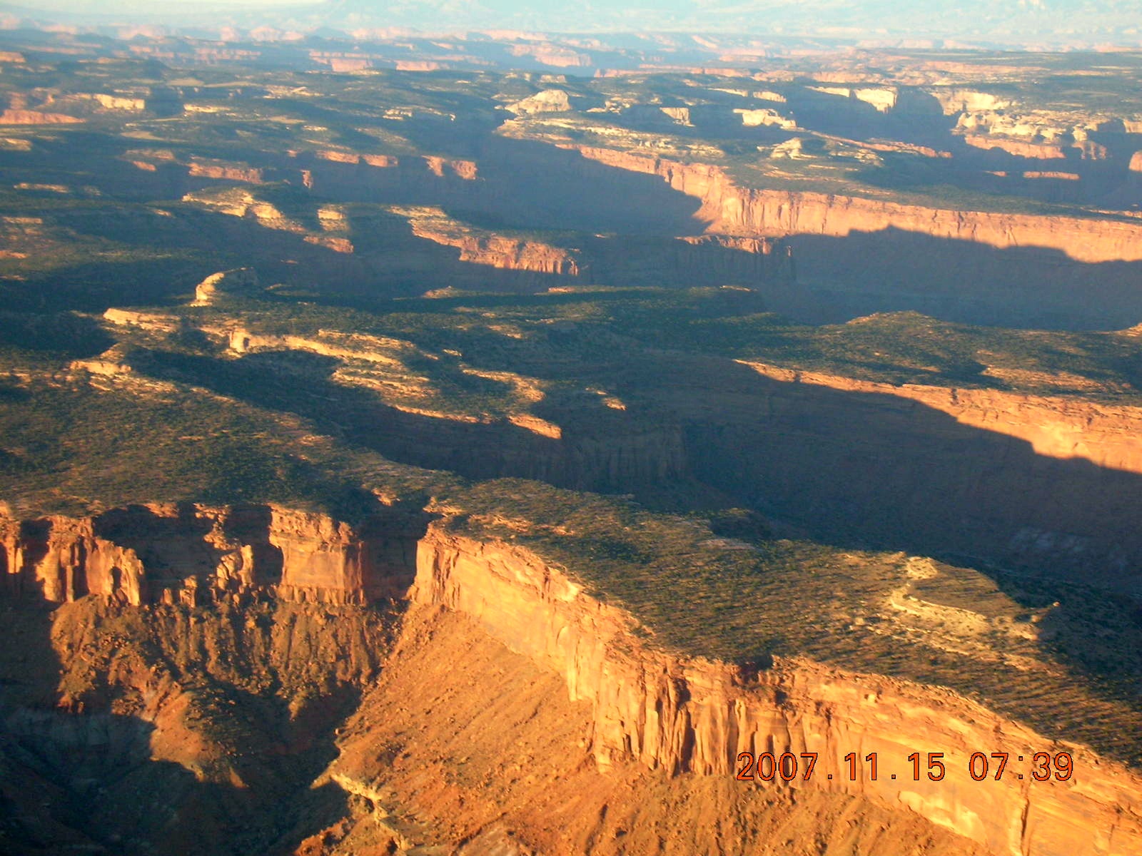
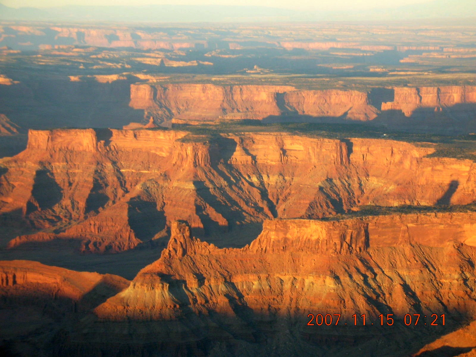
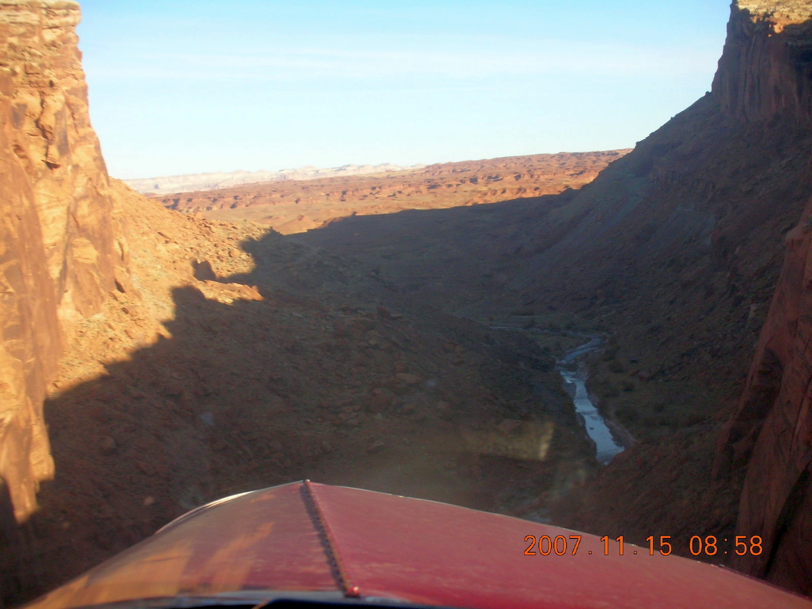
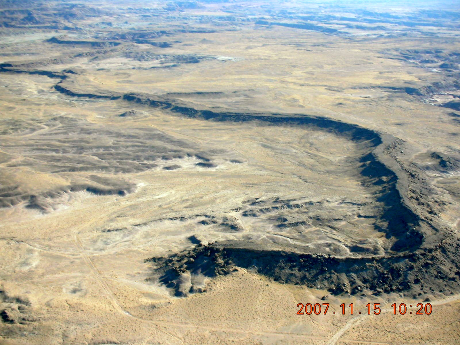
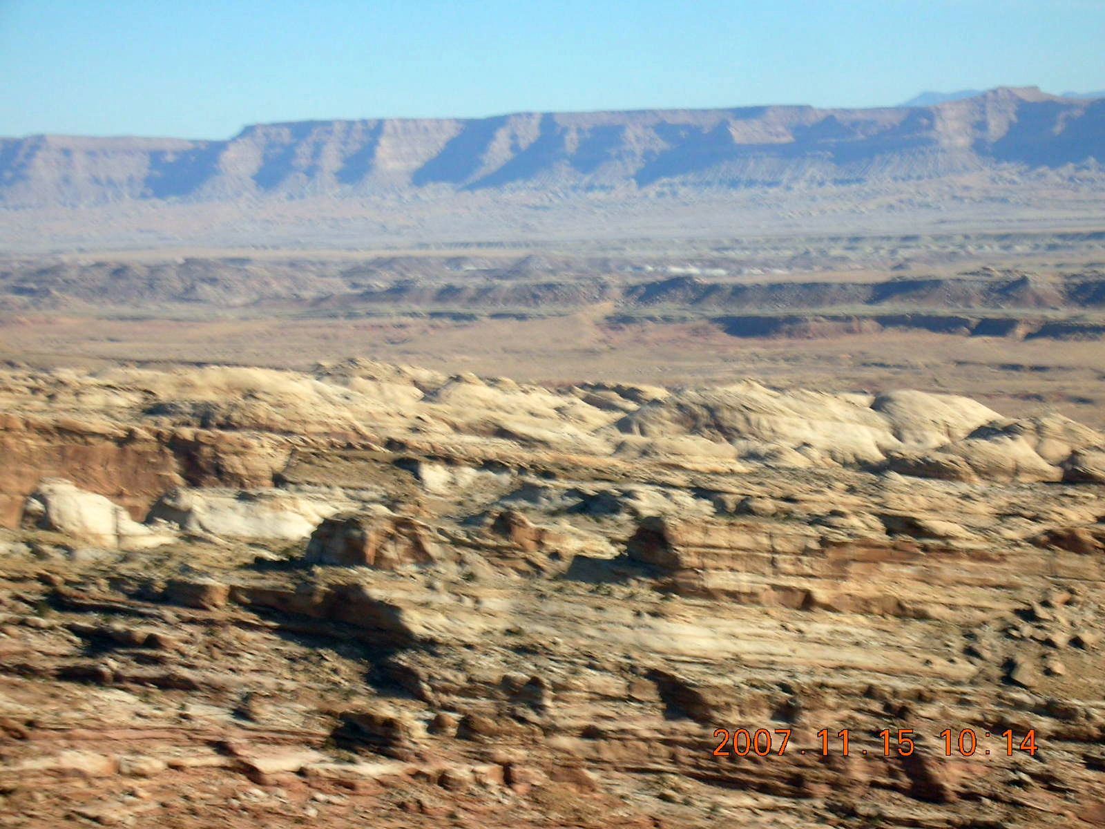
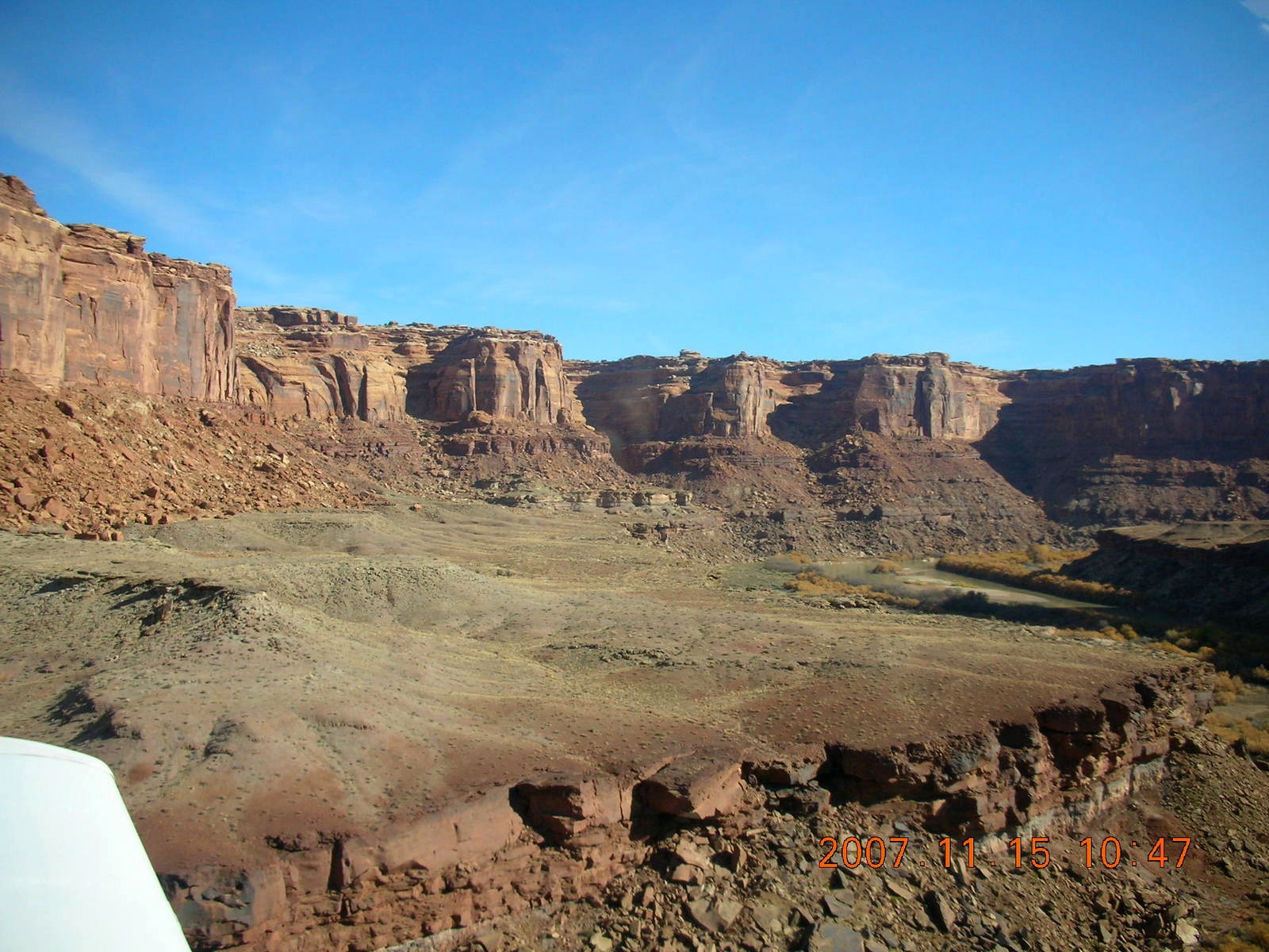
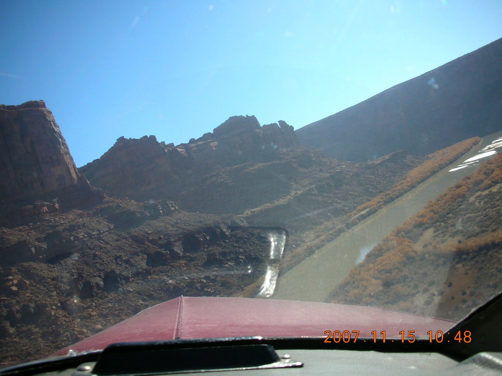
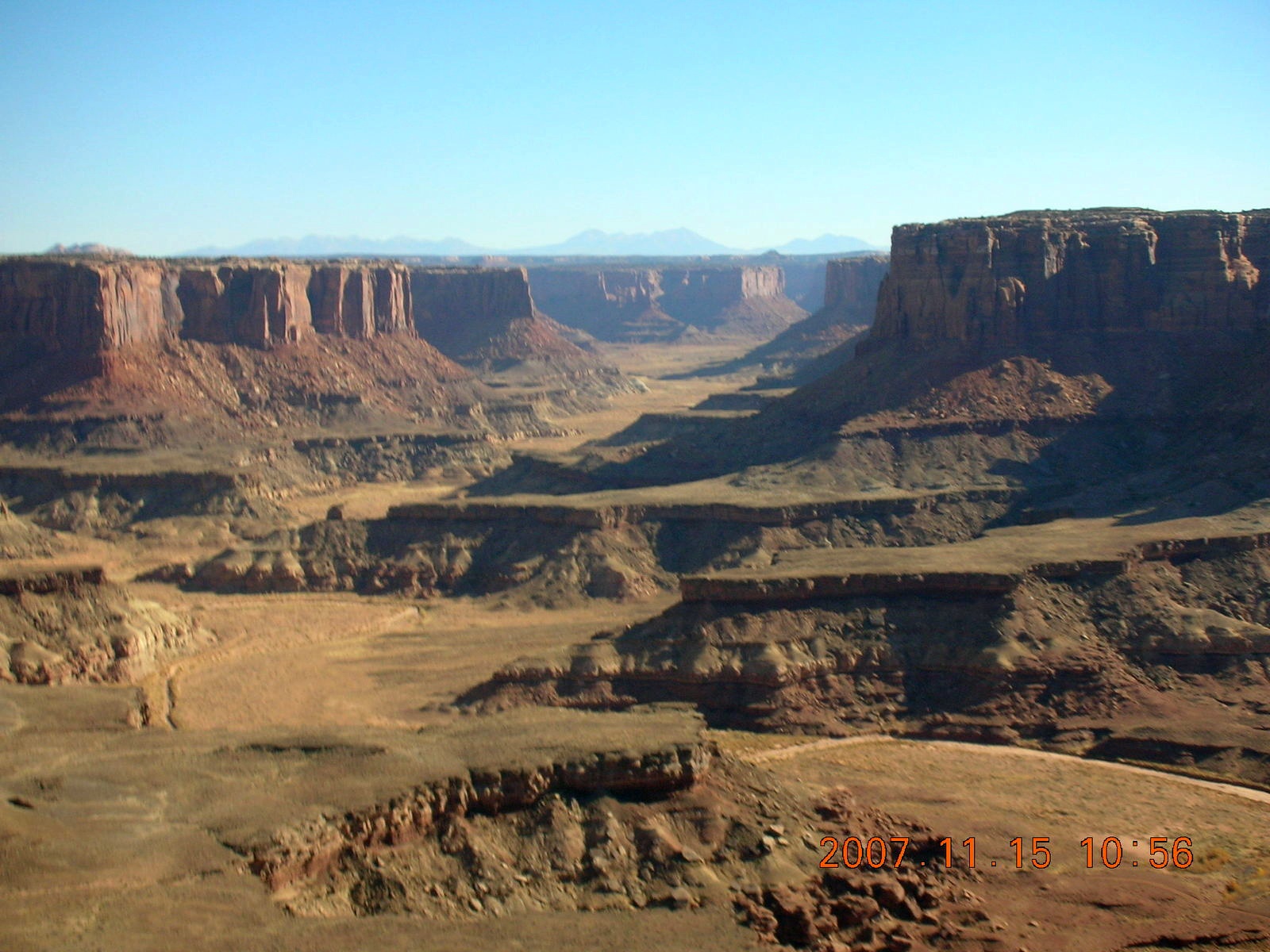
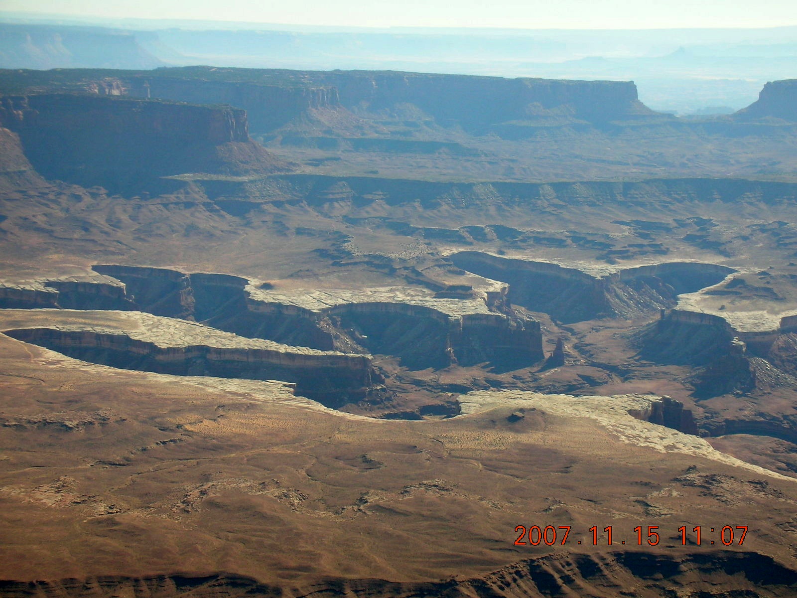
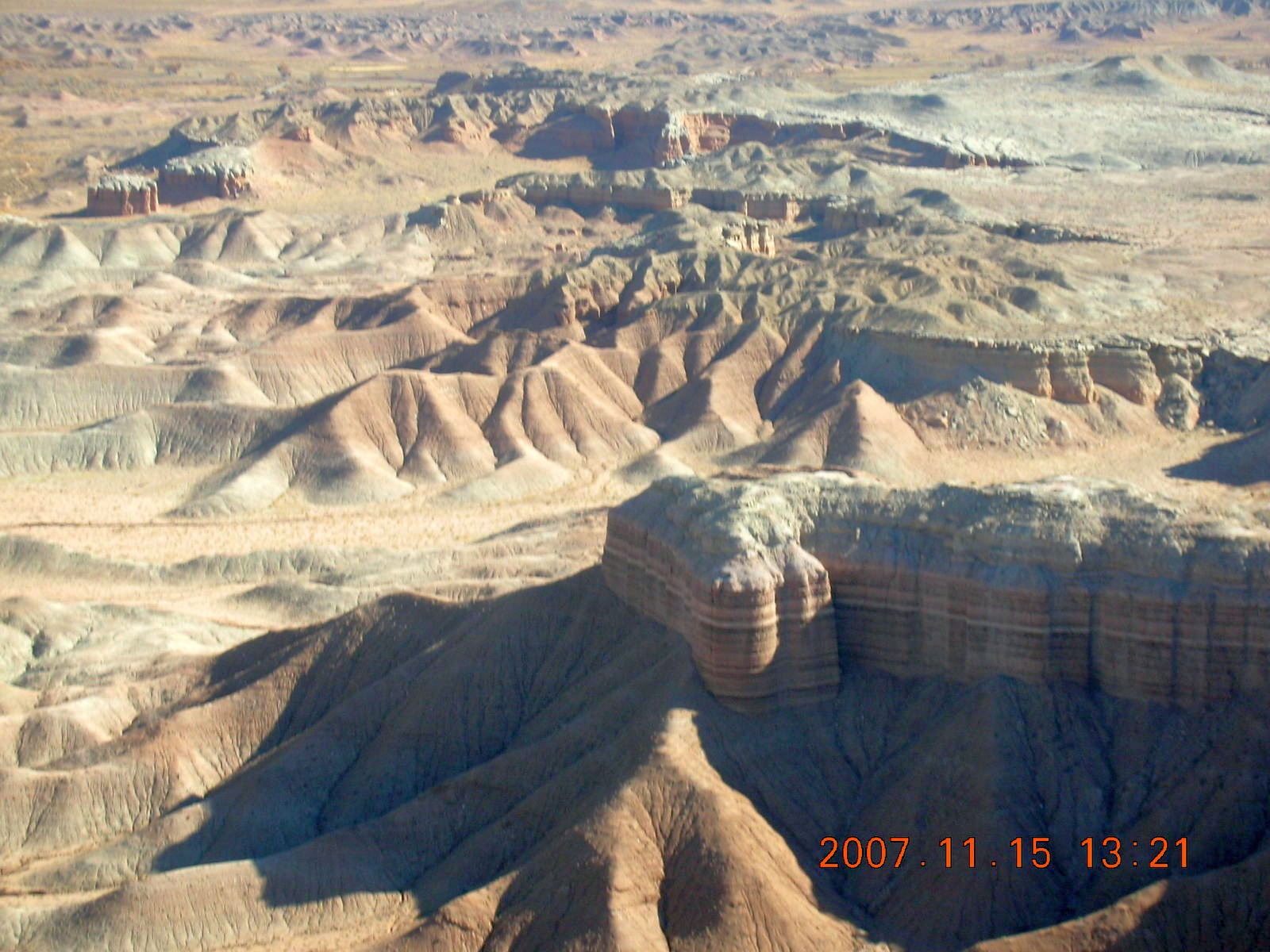
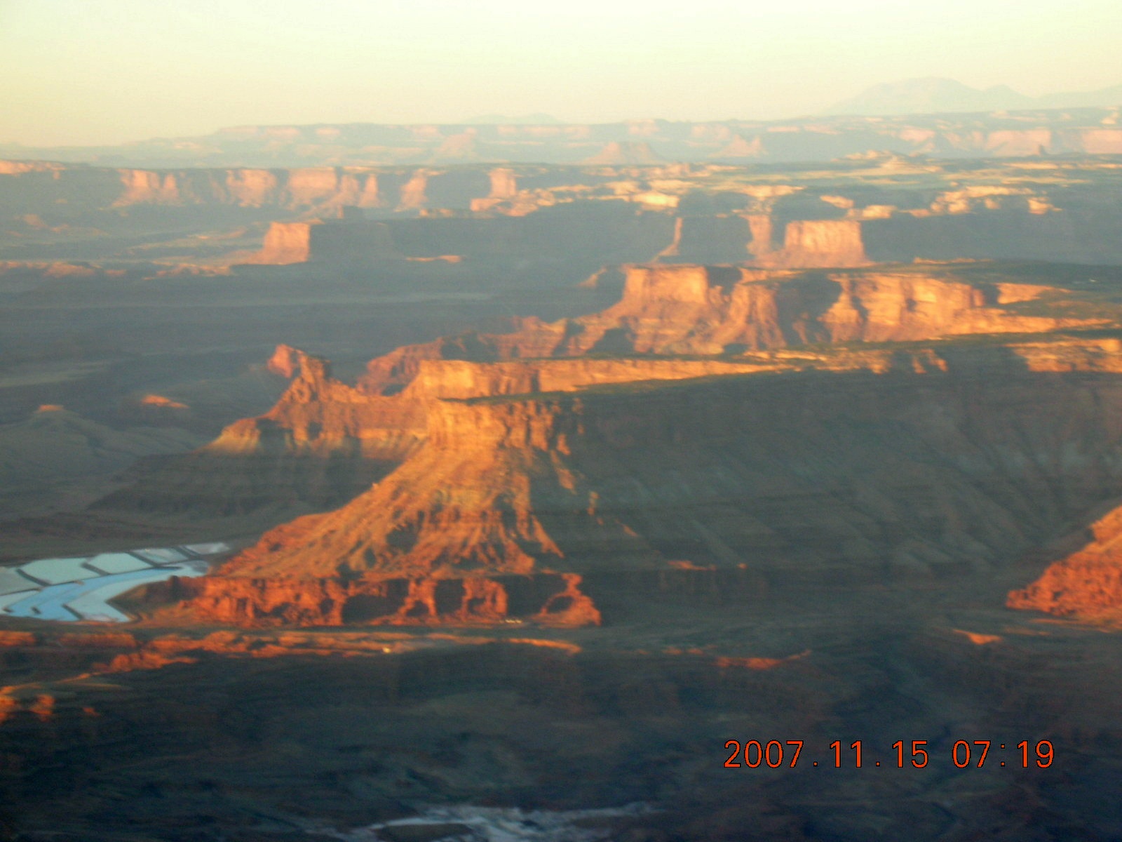
As we left Hidden Splendor, LaVar talked about the geology of this region, some of the rock layers, and he pointed out river beds that were higher than the surrounding countryside. Apparently, the rivers deposited hard limestone when they flowed and that eroded more slowly than the surrounding rock after the rivers dried up.
|

|
|
|
|
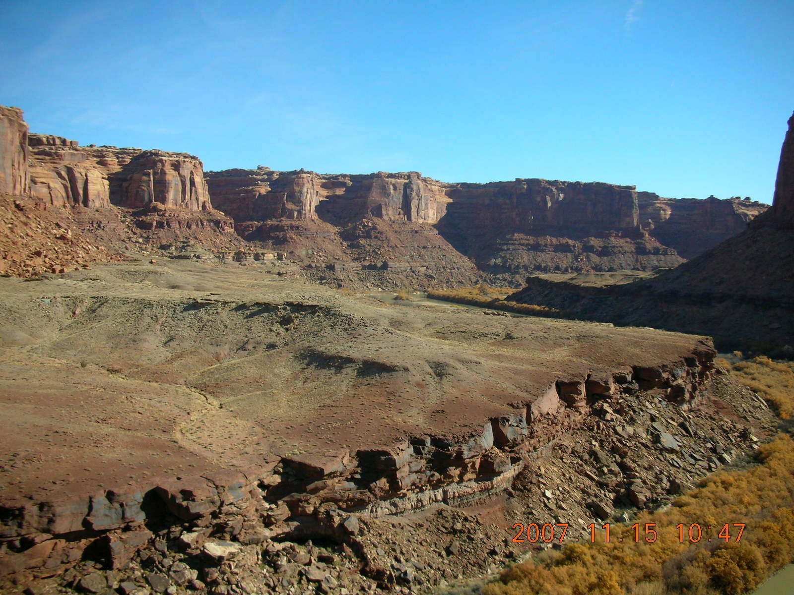
 While I was recovering from earlier challenges,
we headed over some higher terrain and began a descent
into another, wider valley.
Flying around a large hill, or a small mountain,
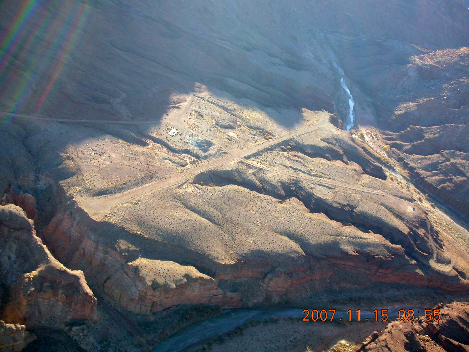
revealed another landing strip,
Mexican Mountain.
Like Hidden Splendor,
it's not on the regular charts from the Federal government,
but it's a purple circle (soft field) denoted
WPT660
on the GH-UT chart.
While I was recovering from earlier challenges,
we headed over some higher terrain and began a descent
into another, wider valley.
Flying around a large hill, or a small mountain,
revealed another landing strip,
Mexican Mountain.
Like Hidden Splendor,
it's not on the regular charts from the Federal government,
but it's a purple circle (soft field) denoted
WPT660
on the GH-UT chart.
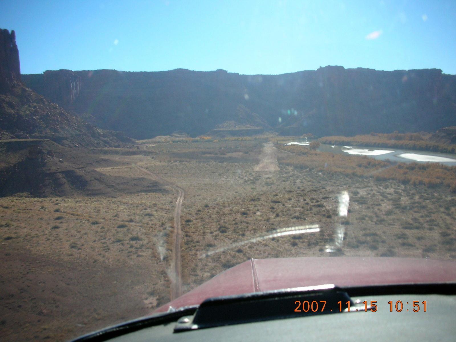
We stopped here for a few minutes for a few reasons. First, my camera had fallen out of my pocket and made its way under my seat, so I wanted to look for it. Second, we wanted to experience the peace and quiet of the Utah wilderness. Third, there are reasons a couple of aging fellows might want to step outside a moving vehicle for a little while.
 After taking in the scenery and enjoying the silence,
LaVar and I got back into my Cherokee and headed out and up.
My airplane is supposed to have 150 horsepower
with new engine and propeller at cruise speeds.
At low airspeeds I wasn't getting that kind of power,
but it was enough to climb out.
Fortunately, most of these remote airstrips
are characterized by narrow approaches
rather than steep departures.
LaVar chose airstrips where my limited engine power
would not be a problem.
After taking in the scenery and enjoying the silence,
LaVar and I got back into my Cherokee and headed out and up.
My airplane is supposed to have 150 horsepower
with new engine and propeller at cruise speeds.
At low airspeeds I wasn't getting that kind of power,
but it was enough to climb out.
Fortunately, most of these remote airstrips
are characterized by narrow approaches
rather than steep departures.
LaVar chose airstrips where my limited engine power
would not be a problem.
The forms and shapes of Utah's wilderness differ widely while the actual rock layers do not. I forget most of the names, but the sheer rock-face layer of sandstone is called "Wingate." I thought LaVar said "windgate" which is the name of a particular formation here in Scottsdale, Arizona, Windgate Pass.
 By now I realized this was a fundamentally new concept for me,
the notion that flying might have to be as precise as landing.
I'm used to the notion that landings have to be precise
and that runway surfaces may not be smooth.
I learned to fly at
Colts Neck Airport
(N61)
where we had 2500 feet (800 meters)
of rough-and-tumble grass runway.
We thought runway designations of 25L and 25R
stood for Lumpy and Rough rather than Left and Right.
When I lived in Justin, Texas,
I based my airplane at
Clark Airport
(3TX6),
1600 feet (500 meters)
from barbed-wire fence at one end
to barbed-wire fence at the other end.
When I lived in Atlanta, Georgia,
I bought automobile fuel for my airplane at
Mathis Airport
(84A)
on a 1500 foot (460 meter) mesa
surrounded by higher hills.
Since I was buying fuel there,
I was always taking off with full fuel tanks.
The difference here is not only does the landing have to be right,
the approach also has to be right on the money.
By now I realized this was a fundamentally new concept for me,
the notion that flying might have to be as precise as landing.
I'm used to the notion that landings have to be precise
and that runway surfaces may not be smooth.
I learned to fly at
Colts Neck Airport
(N61)
where we had 2500 feet (800 meters)
of rough-and-tumble grass runway.
We thought runway designations of 25L and 25R
stood for Lumpy and Rough rather than Left and Right.
When I lived in Justin, Texas,
I based my airplane at
Clark Airport
(3TX6),
1600 feet (500 meters)
from barbed-wire fence at one end
to barbed-wire fence at the other end.
When I lived in Atlanta, Georgia,
I bought automobile fuel for my airplane at
Mathis Airport
(84A)
on a 1500 foot (460 meter) mesa
surrounded by higher hills.
Since I was buying fuel there,
I was always taking off with full fuel tanks.
The difference here is not only does the landing have to be right,
the approach also has to be right on the money.
|
|
|
|
|
 I had one flight-instructor friend point out
that this is inherently less-safe flying
than the usual Sunday-afternoon jaunt between airports.
He's right,
this certainly doesn't have the margin of safety we expect
on a clear day
flying from Warren
(62D)
to Dayton
(DAY)
in the plains of Ohio,
both airports where I have landed my airplane.
On the other hand,
we become better pilots by accepting challenges
a little over our heads
with good instruction to help us stay safe.
LaVar Wells is as good as instructors get.
We fly single-engine airplanes at night
and fly single-pilot IFR (instrument flight rules)
to minimum approach altitudes.
We do multi-engine instruction where we turn off critical engines
close to the ground.
I had one flight-instructor friend point out
that this is inherently less-safe flying
than the usual Sunday-afternoon jaunt between airports.
He's right,
this certainly doesn't have the margin of safety we expect
on a clear day
flying from Warren
(62D)
to Dayton
(DAY)
in the plains of Ohio,
both airports where I have landed my airplane.
On the other hand,
we become better pilots by accepting challenges
a little over our heads
with good instruction to help us stay safe.
LaVar Wells is as good as instructors get.
We fly single-engine airplanes at night
and fly single-pilot IFR (instrument flight rules)
to minimum approach altitudes.
We do multi-engine instruction where we turn off critical engines
close to the ground.
We practice certain maneuvers to hone these burgeoning skills so we can fly better and safer while facing new challenges. Student and private pilots practice stalls and steep turns, commercial pilots practice chandelles and lazy-eights, instrument pilots practice partial-panel and unusual attitudes, and back-country pilots practice flying in a canyon.
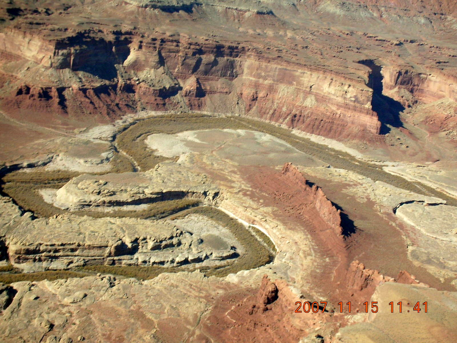
 So here I was flying for half an hour in
the canyon valley of the Green River.
At first it was stressful flying between two walls of rocks,
even when there was more than a wingspan on either side of me.
After a while,
it became comfortable,
even fun,
and the scenery was lovely to look at.
Going into Hidden Splendor
I felt like Luke Skywalker
doing his final attack run at the Death Star.
Here in the Green River canyon I felt relaxed and comfortable,
able to handle the left turns and right turns
as I stayed 100 feet (30 meters) above the water surface.
So here I was flying for half an hour in
the canyon valley of the Green River.
At first it was stressful flying between two walls of rocks,
even when there was more than a wingspan on either side of me.
After a while,
it became comfortable,
even fun,
and the scenery was lovely to look at.
Going into Hidden Splendor
I felt like Luke Skywalker
doing his final attack run at the Death Star.
Here in the Green River canyon I felt relaxed and comfortable,
able to handle the left turns and right turns
as I stayed 100 feet (30 meters) above the water surface.
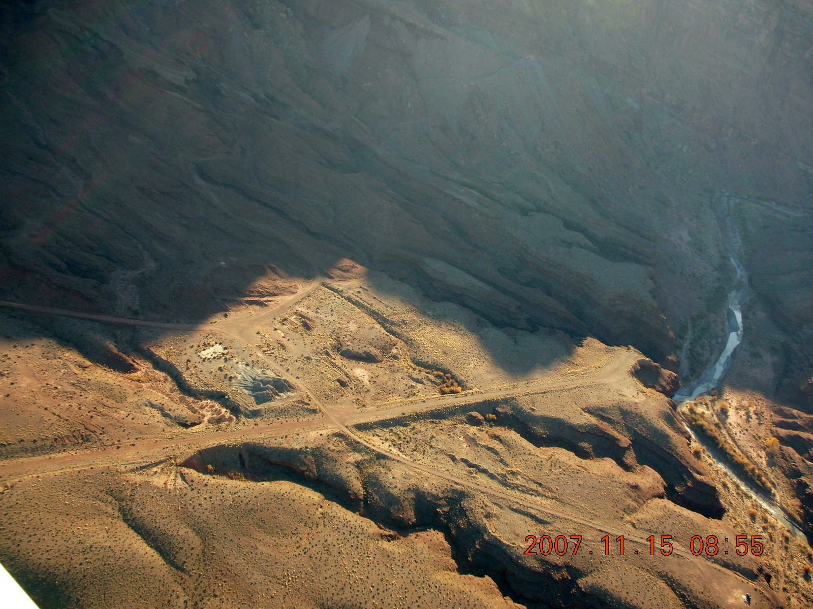
We came upon Mineral Canyon airstrip (UT75) where LaVar suggested we should not actually land after the approach. The Utah Back-Country Pilots Association (UBCP) has posted warnings about Mineral Canyon being too soft, so I was happy to heed all the warnings and to admire the airstrip from just above it.

|
|
|

|
|
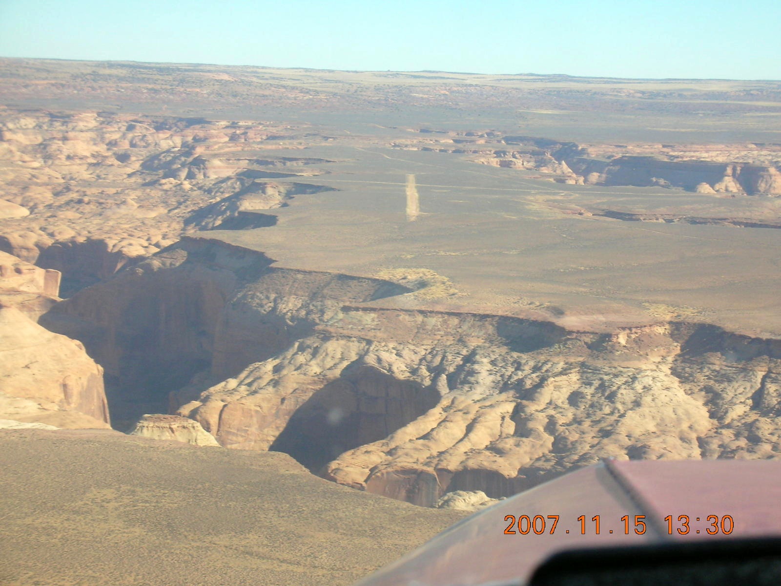
 As we approached Canyonlands National Park,
LaVar asked if I wanted to see Upheaval Dome.
I saw it from the ground and I wasn't impressed
but I figured it might look more impressive from the air.
As we approached Canyonlands National Park,
LaVar asked if I wanted to see Upheaval Dome.
I saw it from the ground and I wasn't impressed
but I figured it might look more impressive from the air.
Remember the scene in the Matthew Broderick version of "Godzilla" where ther're a bunch of guys standing in a depression saying they had seen no sign of a giant-lizard monster? As I remember it, the camera angle widens and the movie watchers see that they're standing in a giant footprint.
Well, that's what happened to me with Upheaval Dome. The trail goes up to the rim of a raised circle so I didn't see it. From the air I saw the double ring of raised and collapsed ground that makes Upheaval Dome interesting.
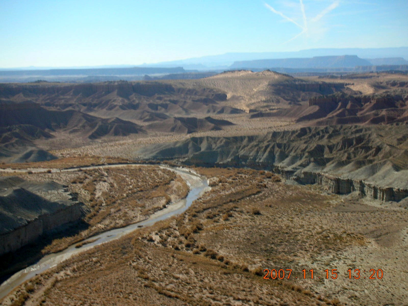
 We headed along Cataract Canyon,
the local canyon of the Colorado River,
to the northern tip of Lake Powell
to land at Hite
(UT03).
This is an airport on the regular sectionals
with the warning "Hazardous" loud and clear on the chart.
What makes this hazardous is that,
as with Hidden Splender and Mexican Mountain,
the straight-in and straight-out flight paths are blocked by rocks.
Instead, the back-country pilot flies
along the Dirty Devil River and makes a hard left turn
to see the runway at the last minute and to land on it.
We headed along Cataract Canyon,
the local canyon of the Colorado River,
to the northern tip of Lake Powell
to land at Hite
(UT03).
This is an airport on the regular sectionals
with the warning "Hazardous" loud and clear on the chart.
What makes this hazardous is that,
as with Hidden Splender and Mexican Mountain,
the straight-in and straight-out flight paths are blocked by rocks.
Instead, the back-country pilot flies
along the Dirty Devil River and makes a hard left turn
to see the runway at the last minute and to land on it.
The runway at Hite has four segments that don't quite line up, but a little rudder footplay is enough to keep the airplane rolling along the narrow, paved runway.
The flight back from Hite to Hanksville was a pleasant and scenic tour of the Dirty Devil River where LaVar pointed out Angel Point and suggested I might land there on my way home. He was telling me I was good enough to try a back-country landing on my own, at least this one. He didn't suggest I go back and shoot a few touch-and-go approaches at Hidden Splendor.

|
|
|

|

|
 After I left Hanksville,
I headed for Angel Point
(WPT706).
It's a short, narrow airstrip, rough enough to be interesting
and I was able to land on it,
to find room to turn around (not that easy in tight quarters),
and to take off again.
After I left Hanksville,
I headed for Angel Point
(WPT706).
It's a short, narrow airstrip, rough enough to be interesting
and I was able to land on it,
to find room to turn around (not that easy in tight quarters),
and to take off again.
I didn't miss the opportunity to do more aerial sightseeing on the way back to Canyonlands Airport (CNY) including another gawk at Upheaval Dome.
When I got back and landed at Canyonlands Airport, I had another first occasion. With aviation-gasoline prices at four-something per gallon, my five-and-a-half (5.5) hours of flying used enough fuel for me to have my first two-hundred-dollar (USD $200) fill-up. Somehow I didn't mind.
(This adventure continues a year later in another flight with LaVar.)
|
| |
|

|
|
|
20:51:35 Mountain Standard Time (MST). 2278 visits to this web page. |