|
|
|
|
|
|
|
|
2004 June 25
|
|
|
|
|
|
|
|
|
|
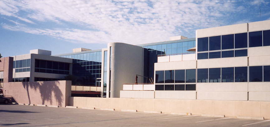
 My company,
Khimetrics
is moving from one building to another in Scottsdale, Arizona,
These guys planned the entire move with precision
for 2004 June 25, Friday,
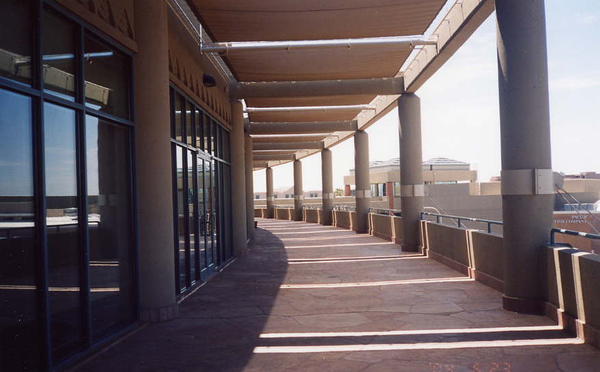
and we were told to leave Thursday afternoon
and to stay away all day Friday.
I decided a free day off was something to celebrate with a
flying adventure,
a trip someplace I wouldn't normally go.
My company,
Khimetrics
is moving from one building to another in Scottsdale, Arizona,
These guys planned the entire move with precision
for 2004 June 25, Friday,
and we were told to leave Thursday afternoon
and to stay away all day Friday.
I decided a free day off was something to celebrate with a
flying adventure,
a trip someplace I wouldn't normally go.
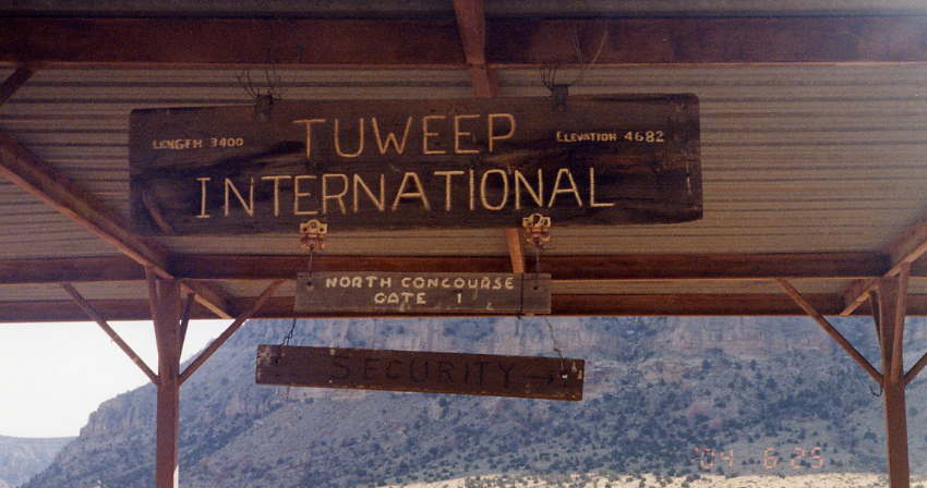
I stuck my finger on the map (an aviation chart of the Grand Canyon, actually) and picked a small dirt landing strip called Tuweep (L50) on the North Rim. I poked around on the World Wide Web and found out that it's 12.5 Km (7.8 miles) on a dirt road from the unattended airport from the airport to an amazing view at the rim. The pilot who used to work at the ranger station moved to Alaska. I planned my two-hour flight and checked the weather. The Weather Channel forecast 31° C. (88° F.) with isolated thunderstorms in the afternoon.
 I'm both a
pilot
and a runner
with enough experience to make this trip
and enough experience to respect its challenges.
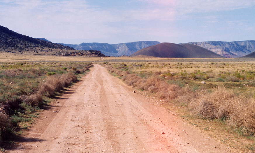
There might not be a soul at the airport,
at the ranger station,
along the eight miles of
lonely dirt road,
or at the rim,
so I brought a lot of water in the airplane
and carried two liters and two "energy bars"
in a pack on my back
along with a fanny pack with a camera and plenty of film.
I'm both a
pilot
and a runner
with enough experience to make this trip
and enough experience to respect its challenges.
There might not be a soul at the airport,
at the ranger station,
along the eight miles of
lonely dirt road,
or at the rim,
so I brought a lot of water in the airplane
and carried two liters and two "energy bars"
in a pack on my back
along with a fanny pack with a camera and plenty of film.
 The 2.3-hour flight at dawn
from Scottsdale (SDL) to Tuweep (L50)
was smooth with clear skies.
Landing on a 1000 meter (3400 foot) runway
with a few bumps and weeds
did not intimidate me
as I learned to fly at Colts Neck Airport
(N61),
a rough and muddy grass strip
in far worse shape than Tuweep.
The temperature was already 32° C. (90° F.),
even at 7:30 in the morning.
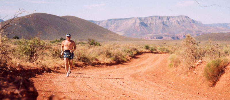
In spite of the heat,
the eight-mile run to the rim was quiet and pleasant as I expected
with not a soul along the way,
not at the airport,
not at the ranger station,
and not along the road.
The 2.3-hour flight at dawn
from Scottsdale (SDL) to Tuweep (L50)
was smooth with clear skies.
Landing on a 1000 meter (3400 foot) runway
with a few bumps and weeds
did not intimidate me
as I learned to fly at Colts Neck Airport
(N61),
a rough and muddy grass strip
in far worse shape than Tuweep.
The temperature was already 32° C. (90° F.),
even at 7:30 in the morning.
In spite of the heat,
the eight-mile run to the rim was quiet and pleasant as I expected
with not a soul along the way,
not at the airport,
not at the ranger station,
and not along the road.
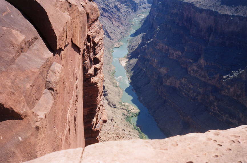
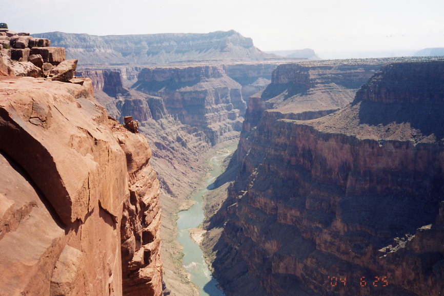
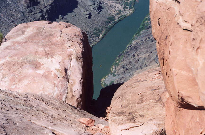
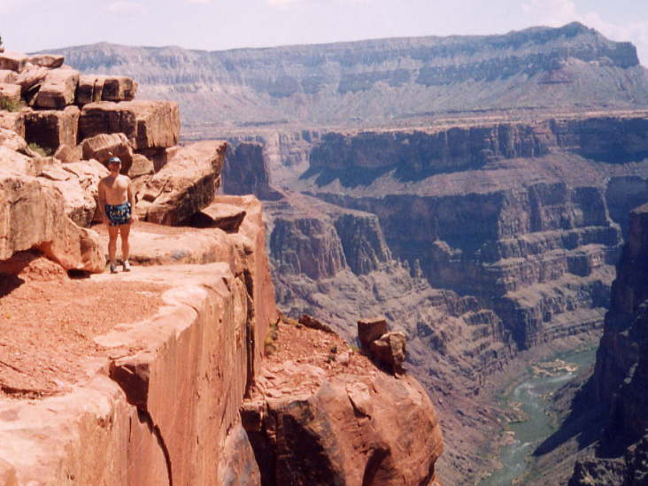
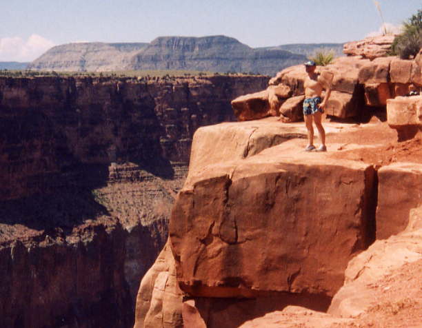
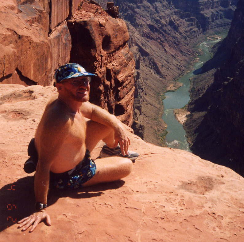
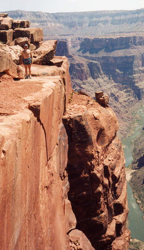 The
Toroweap view
is heart-stopping.
It took me a few minutes to get enough courage
to step down onto the rocks
and to peek down at the river.
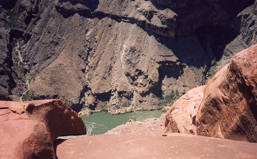
It's 800 meters, half a mile,
almost straight down from the ledge to the river.
Once I got past the obstacle
from trembly fear to appropriate caution,
I could appreciate the exhilarating view.
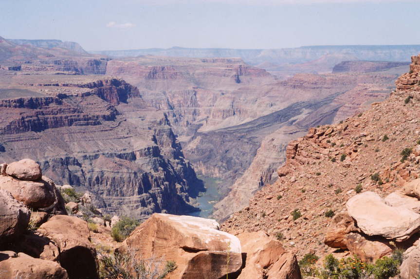
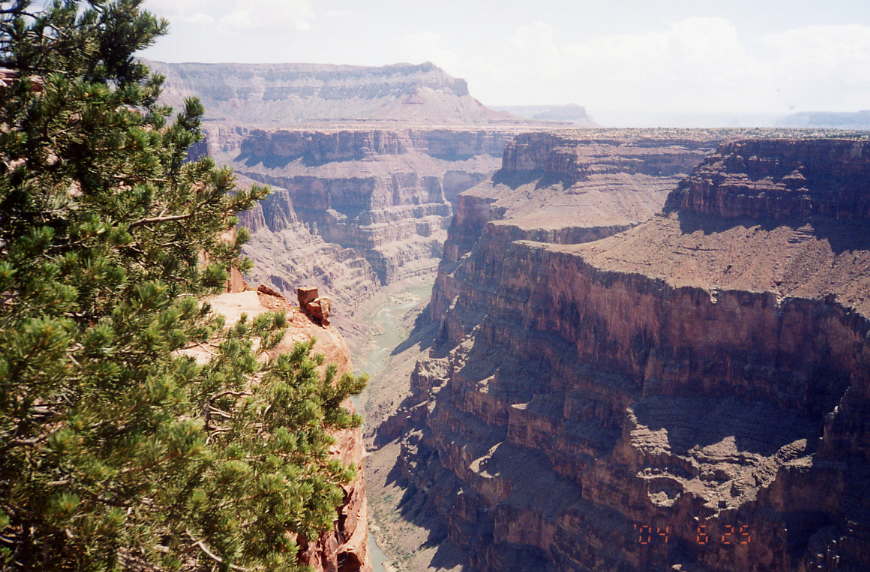
The Grand Canyon view is, well, grand.
The full canyon is 15 to 30 Km
(10 to 20 miles) wide
and there is an narrower inner canyon with
the Colorado River at the very bottom.
At Toroweap, the inner canyon is
less than a mile across
with nearly vertical walls.
The
Toroweap view
is heart-stopping.
It took me a few minutes to get enough courage
to step down onto the rocks
and to peek down at the river.
It's 800 meters, half a mile,
almost straight down from the ledge to the river.
Once I got past the obstacle
from trembly fear to appropriate caution,
I could appreciate the exhilarating view.
The Grand Canyon view is, well, grand.
The full canyon is 15 to 30 Km
(10 to 20 miles) wide
and there is an narrower inner canyon with
the Colorado River at the very bottom.
At Toroweap, the inner canyon is
less than a mile across
with nearly vertical walls.
A few kilometers southwest, downriver, is Lava Falls, reported to be the world's most severe whitewater rafting spot. There is a 2.5 Km (1.5 mile) trail that drops down to the river, an average incline of 32%. Stories of loose rock (scree), glass-sharp obsidian, and the occasional rattlesnake made it quite obvious that this trail was not for a hiking novice like me. The view from the rim is satisfying enough for me without confronting the dangers of Lava Falls Trail.
 By the time I headed back,
the temperature had reached 38° C. (100° F.).
Fortunately, there were a couple of people
who were adventurous enough to drive
the 100 Km (63 miles) of dirt road
to see this view for themselves
and one of them gave me some water
to augment the supply I was carrying on my back.
It is important to remember that places like Tuweep
can be
totally desolate,
not a person anywhere.
In my case, I did have some help and I appreciated it,
but I was able to make it to the rim and back on my own two feet,
even in the hot weather.
I was also able to get my airplane out of Tuweep Airport
with runway to spare.
By the time I headed back,
the temperature had reached 38° C. (100° F.).
Fortunately, there were a couple of people
who were adventurous enough to drive
the 100 Km (63 miles) of dirt road
to see this view for themselves
and one of them gave me some water
to augment the supply I was carrying on my back.
It is important to remember that places like Tuweep
can be
totally desolate,
not a person anywhere.
In my case, I did have some help and I appreciated it,
but I was able to make it to the rim and back on my own two feet,
even in the hot weather.
I was also able to get my airplane out of Tuweep Airport
with runway to spare.
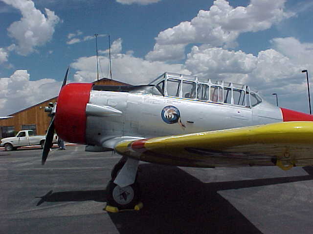
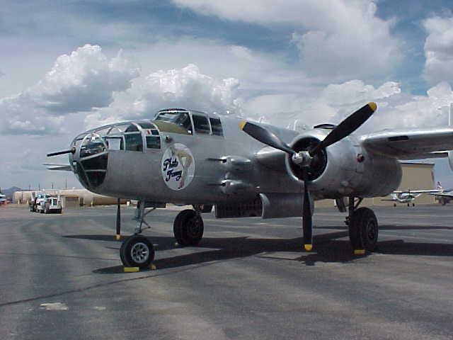 I made another stop on my way back
at Valle Airport
(40G),
home of the Planes of Fame museum,
but my feet were too tired to stop there on this trip.
(They also have vintage cars and motorcycles at the airport.)
I'll have to come back and do the museum next time.
I made another stop on my way back
at Valle Airport
(40G),
home of the Planes of Fame museum,
but my feet were too tired to stop there on this trip.
(They also have vintage cars and motorcycles at the airport.)
I'll have to come back and do the museum next time.
|
23:07:50 Mountain Standard Time (MST). 1461 visits to this web page. |